<?xml version="1.0" encoding="utf-8"?>
<feed xmlns="http://www.w3.org/2005/Atom" xmlns:media="http://search.yahoo.com/mrss/">
    <title>Tim&#x27;s Derbyshire Railway Walks</title>
    <link href="https://railwaywalks.timholyoake.uk/feed.xml" rel="self" />
    <link href="https://railwaywalks.timholyoake.uk" />
    <updated>2024-10-29T20:50:51+00:00</updated>
    <author>
        <name>tim</name>
    </author>
    <id>https://railwaywalks.timholyoake.uk</id>

    <entry>
        <title>Walk 10 - Parsley Hay to Friden</title>
        <author>
            <name>tim</name>
        </author>
        <link href="https://railwaywalks.timholyoake.uk/walk10/"/>
        <id>https://railwaywalks.timholyoake.uk/walk10/</id>
        <media:content url="https://railwaywalks.timholyoake.uk/media/posts/11/20241029_111503-scaled.jpg" medium="image" />

        <updated>2024-10-29T19:07:40+00:00</updated>
            <summary type="html">
                <![CDATA[
                        <img src="https://railwaywalks.timholyoake.uk/media/posts/11/20241029_111503-scaled.jpg" alt="A herd of bloack and white dairy cows behind a gate, waiting to be milked" />
                    Today's walk is the last in this series. Thank you to everyone who has donated to Lymphoma Action. At the time of writing, these walks (and one cycle ride) have raised a brilliant £275. If you'd still like to donate you can do - simply&hellip;
                ]]>
            </summary>
        <content type="html">
            <![CDATA[
                    <p><img src="https://railwaywalks.timholyoake.uk/media/posts/11/20241029_111503-scaled.jpg" class="type:primaryImage" alt="A herd of bloack and white dairy cows behind a gate, waiting to be milked" /></p>
                Today's walk is the last in this series. Thank you to everyone who has donated to Lymphoma Action. At the time of writing, these walks (and one cycle ride) have raised a brilliant £275. If you'd still like to donate you can do - <a href="https://www.justgiving.com/page/derbyshire-railway-trails-walk">simply follow this link</a>.

When I set out from home it looked as if the weather was going to be reasonable. By the time I'd driven to Ashbourne, there were a few spots of rain. By the time I'd left Ashbourne, the heavens had opened. Fortunately by the time I reached Parsley Hay the rain had stopped, even if the skies looked threatening.
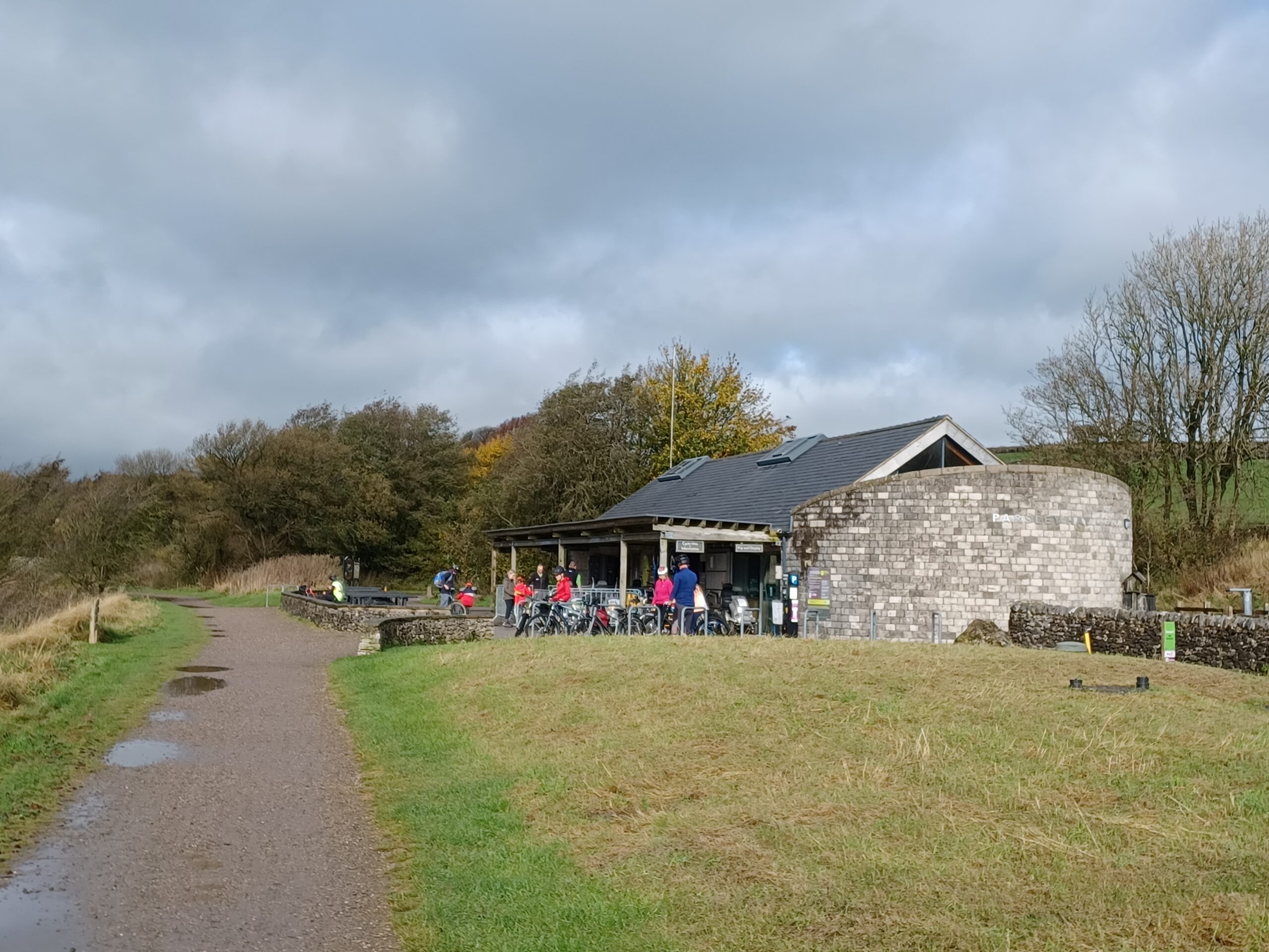
<figure class="post__image post__image--center"><img loading="lazy" src="https://railwaywalks.timholyoake.uk/media/posts/11/20241029_102937-scaled.jpg" alt="Dark clouds over the visitor centre at Parsley Hay" width="2560" height="1920"  sizes="(max-width: 1920px) 100vw, 1920px" srcset="https://railwaywalks.timholyoake.uk/media/posts/11/responsive/20241029_102937-scaled-xs.jpg 640w ,https://railwaywalks.timholyoake.uk/media/posts/11/responsive/20241029_102937-scaled-sm.jpg 768w ,https://railwaywalks.timholyoake.uk/media/posts/11/responsive/20241029_102937-scaled-md.jpg 1024w ,https://railwaywalks.timholyoake.uk/media/posts/11/responsive/20241029_102937-scaled-lg.jpg 1366w ,https://railwaywalks.timholyoake.uk/media/posts/11/responsive/20241029_102937-scaled-xl.jpg 1600w ,https://railwaywalks.timholyoake.uk/media/posts/11/responsive/20241029_102937-scaled-2xl.jpg 1920w"><figcaption>Dark clouds over the visitor centre at Parsley Hay</figcaption></figure>

I dithered over which way to walk. In the end, the promise of a tunnel sent me South towards Friden. I do love a good tunnel, and the one a few hundred metres from Parsley Hay is lovely. It's not as long as the tunnels on the Monsal Trail, but it's beautifully engineered.

<figure class="post__image post__image--center"><img loading="lazy" src="https://railwaywalks.timholyoake.uk/media/posts/11/20241029_104040-scaled.jpg" alt="A railway cutting, with steep banks covered in vegetation. The path through the cutting is wet. There's a tunnel portal at the end, built in white-grey peak district stone." width="2560" height="1920"  sizes="(max-width: 1920px) 100vw, 1920px" srcset="https://railwaywalks.timholyoake.uk/media/posts/11/responsive/20241029_104040-scaled-xs.jpg 640w ,https://railwaywalks.timholyoake.uk/media/posts/11/responsive/20241029_104040-scaled-sm.jpg 768w ,https://railwaywalks.timholyoake.uk/media/posts/11/responsive/20241029_104040-scaled-md.jpg 1024w ,https://railwaywalks.timholyoake.uk/media/posts/11/responsive/20241029_104040-scaled-lg.jpg 1366w ,https://railwaywalks.timholyoake.uk/media/posts/11/responsive/20241029_104040-scaled-xl.jpg 1600w ,https://railwaywalks.timholyoake.uk/media/posts/11/responsive/20241029_104040-scaled-2xl.jpg 1920w"><figcaption>The tunnel</figcaption></figure>

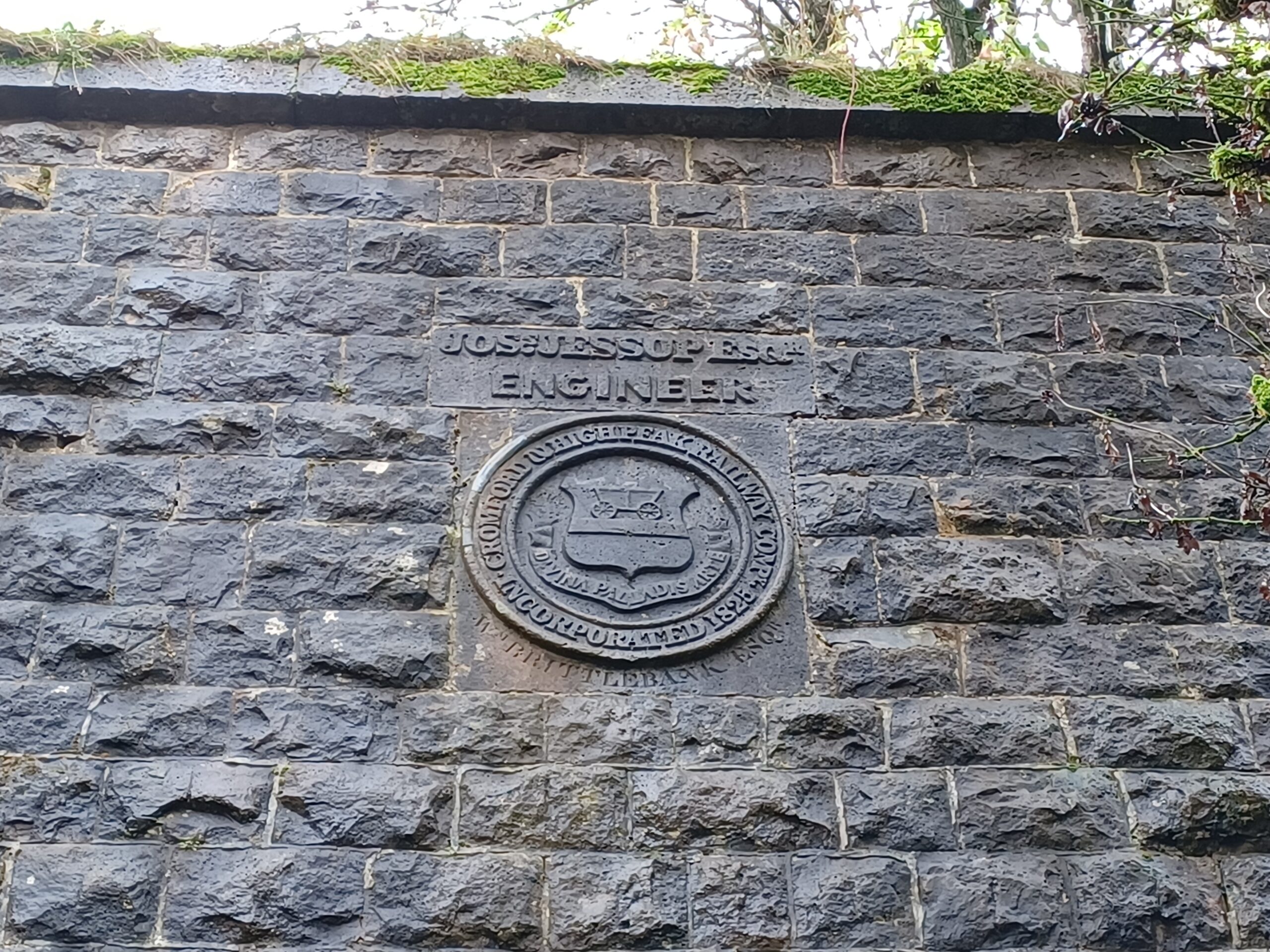
So beautiful that the engineer even wanted to be associated with it forever - there's a plaque in the stonework over the tunnel celebrating his achievement.

<figure class="post__image post__image--center"><img loading="lazy" src="https://railwaywalks.timholyoake.uk/media/posts/11/20241029_104116-scaled.jpg" alt="The plaque over the tunnel in the previous photo. It celebrates Joseph Jessop Esq, Engineer." width="2560" height="1920"  sizes="(max-width: 1920px) 100vw, 1920px" srcset="https://railwaywalks.timholyoake.uk/media/posts/11/responsive/20241029_104116-scaled-xs.jpg 640w ,https://railwaywalks.timholyoake.uk/media/posts/11/responsive/20241029_104116-scaled-sm.jpg 768w ,https://railwaywalks.timholyoake.uk/media/posts/11/responsive/20241029_104116-scaled-md.jpg 1024w ,https://railwaywalks.timholyoake.uk/media/posts/11/responsive/20241029_104116-scaled-lg.jpg 1366w ,https://railwaywalks.timholyoake.uk/media/posts/11/responsive/20241029_104116-scaled-xl.jpg 1600w ,https://railwaywalks.timholyoake.uk/media/posts/11/responsive/20241029_104116-scaled-2xl.jpg 1920w"><figcaption>The plaque</figcaption></figure>

It's easy to get carried away by the beauty of the Peak District. There was a lovely moss-covered dry stone wall on the route, the bright green contrasting with the leaves slowly gaining their autumn colours.

<figure class="post__image post__image--center"><img loading="lazy" src="https://railwaywalks.timholyoake.uk/media/posts/11/20241029_1052271-scaled.jpg" alt="A dry stone wall covered in green moss. Behind the wall is a wood, with the trees starting to lose their leaves." width="2560" height="1920"  sizes="(max-width: 1920px) 100vw, 1920px" srcset="https://railwaywalks.timholyoake.uk/media/posts/11/responsive/20241029_1052271-scaled-xs.jpg 640w ,https://railwaywalks.timholyoake.uk/media/posts/11/responsive/20241029_1052271-scaled-sm.jpg 768w ,https://railwaywalks.timholyoake.uk/media/posts/11/responsive/20241029_1052271-scaled-md.jpg 1024w ,https://railwaywalks.timholyoake.uk/media/posts/11/responsive/20241029_1052271-scaled-lg.jpg 1366w ,https://railwaywalks.timholyoake.uk/media/posts/11/responsive/20241029_1052271-scaled-xl.jpg 1600w ,https://railwaywalks.timholyoake.uk/media/posts/11/responsive/20241029_1052271-scaled-2xl.jpg 1920w"><figcaption>Dry stone wall</figcaption></figure>

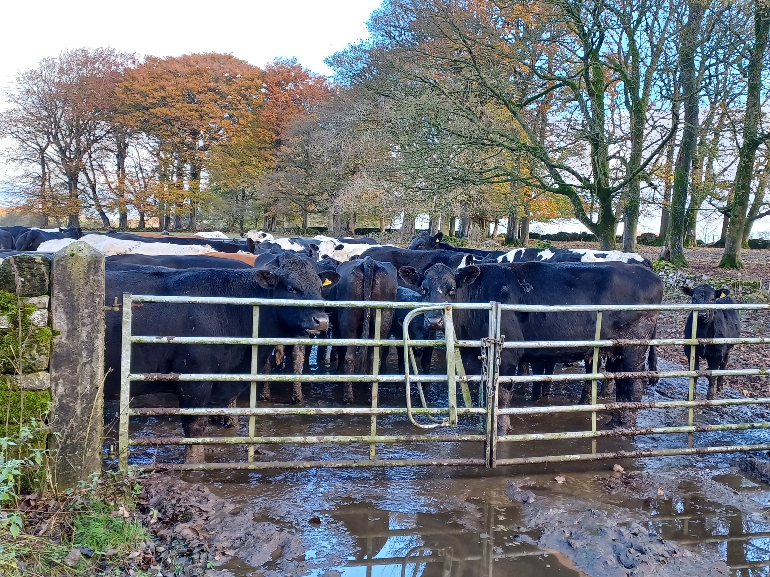
But it was, and remains a working landscape. Just before the former goods yard at Friden, a farmer's cows waited to be milked.

<figure class="post__image post__image--center"><img loading="lazy" src="https://railwaywalks.timholyoake.uk/media/posts/11/20241029_111503-scaled.jpg" alt="A herd of bloack and white dairy cows behind a gate, waiting to be milked" width="2560" height="1920"  sizes="(max-width: 1920px) 100vw, 1920px" srcset="https://railwaywalks.timholyoake.uk/media/posts/11/responsive/20241029_111503-scaled-xs.jpg 640w ,https://railwaywalks.timholyoake.uk/media/posts/11/responsive/20241029_111503-scaled-sm.jpg 768w ,https://railwaywalks.timholyoake.uk/media/posts/11/responsive/20241029_111503-scaled-md.jpg 1024w ,https://railwaywalks.timholyoake.uk/media/posts/11/responsive/20241029_111503-scaled-lg.jpg 1366w ,https://railwaywalks.timholyoake.uk/media/posts/11/responsive/20241029_111503-scaled-xl.jpg 1600w ,https://railwaywalks.timholyoake.uk/media/posts/11/responsive/20241029_111503-scaled-2xl.jpg 1920w"><figcaption>Moo!</figcaption></figure>

Less than 50 metres further on you can hear and smell specialist bricks being made. They have been produced on this site for over 130 years. There's a set of interesting murals and information boards on the walls of the factory, erected in 2001 by retired employees.

<figure class="post__image post__image--center"><img loading="lazy" src="https://railwaywalks.timholyoake.uk/media/posts/11/20241029_111833-scaled.jpg" alt="The DSF brickworks. There's a factory building in the foreground and two chimneys, one modern, one old in the background that belong to it. On the wall of the factory is an information board and mural." width="2560" height="1920"  sizes="(max-width: 1920px) 100vw, 1920px" srcset="https://railwaywalks.timholyoake.uk/media/posts/11/responsive/20241029_111833-scaled-xs.jpg 640w ,https://railwaywalks.timholyoake.uk/media/posts/11/responsive/20241029_111833-scaled-sm.jpg 768w ,https://railwaywalks.timholyoake.uk/media/posts/11/responsive/20241029_111833-scaled-md.jpg 1024w ,https://railwaywalks.timholyoake.uk/media/posts/11/responsive/20241029_111833-scaled-lg.jpg 1366w ,https://railwaywalks.timholyoake.uk/media/posts/11/responsive/20241029_111833-scaled-xl.jpg 1600w ,https://railwaywalks.timholyoake.uk/media/posts/11/responsive/20241029_111833-scaled-2xl.jpg 1920w"><figcaption>DSF brickworks, Friden</figcaption></figure>

The landscape around here shows signs of human habitation for hundreds, if not thousands of years. Look at the map below and you'll see alongside my route the remains of a Roman Road, a stone circle and many ancient burial grounds.

<figure class="post__image post__image--center"><img loading="lazy" src="https://railwaywalks.timholyoake.uk/media/posts/11/2024-10-29-185442_1920x1080_scrot.png" alt="An OS map of my route today." width="1150" height="721"  sizes="(max-width: 1920px) 100vw, 1920px" srcset="https://railwaywalks.timholyoake.uk/media/posts/11/responsive/2024-10-29-185442_1920x1080_scrot-xs.png 640w ,https://railwaywalks.timholyoake.uk/media/posts/11/responsive/2024-10-29-185442_1920x1080_scrot-sm.png 768w ,https://railwaywalks.timholyoake.uk/media/posts/11/responsive/2024-10-29-185442_1920x1080_scrot-md.png 1024w ,https://railwaywalks.timholyoake.uk/media/posts/11/responsive/2024-10-29-185442_1920x1080_scrot-lg.png 1366w ,https://railwaywalks.timholyoake.uk/media/posts/11/responsive/2024-10-29-185442_1920x1080_scrot-xl.png 1600w ,https://railwaywalks.timholyoake.uk/media/posts/11/responsive/2024-10-29-185442_1920x1080_scrot-2xl.png 1920w"><figcaption>Parsley Hay to Friden. OS sheet 111 (Buxton and Matlock), 1962. Reproduced with the permission of the National Library of Scotland.</figcaption></figure>

I had intended to walk a little further towards Minniglow, but I was still suffering the after-effects of a double flu and covid vaccination. I ate my emergency rations on the picnic table in the car park and headed back to Parsley Hay for a bacon roll instead.

Just after returning through the tunnel outside Parsley Hay, I was nearly run down by a group of elderly cyclists in high viz jackets riding two or three abreast along a narrow part of the trail. They claimed not to have seen me. They were too busy talking to each other to notice that I'd had to jump out of their way into a hedge at the last moment. As they rode off one of the ladies suggested that I needed to be more careful in future. Grrrr.

Of all of the walks I've done, this was the closest I came to injury, so I'm extremely grateful that I kept my 100% accident-free record!

Today I covered 9.27km, 11,871 steps, in 2hours, 20 minutes and 47 seconds.

In total, over the ten walks (really 9 walks and 1 bike ride), I covered 142.85km, 100.99km walking, 41.86km cycling.

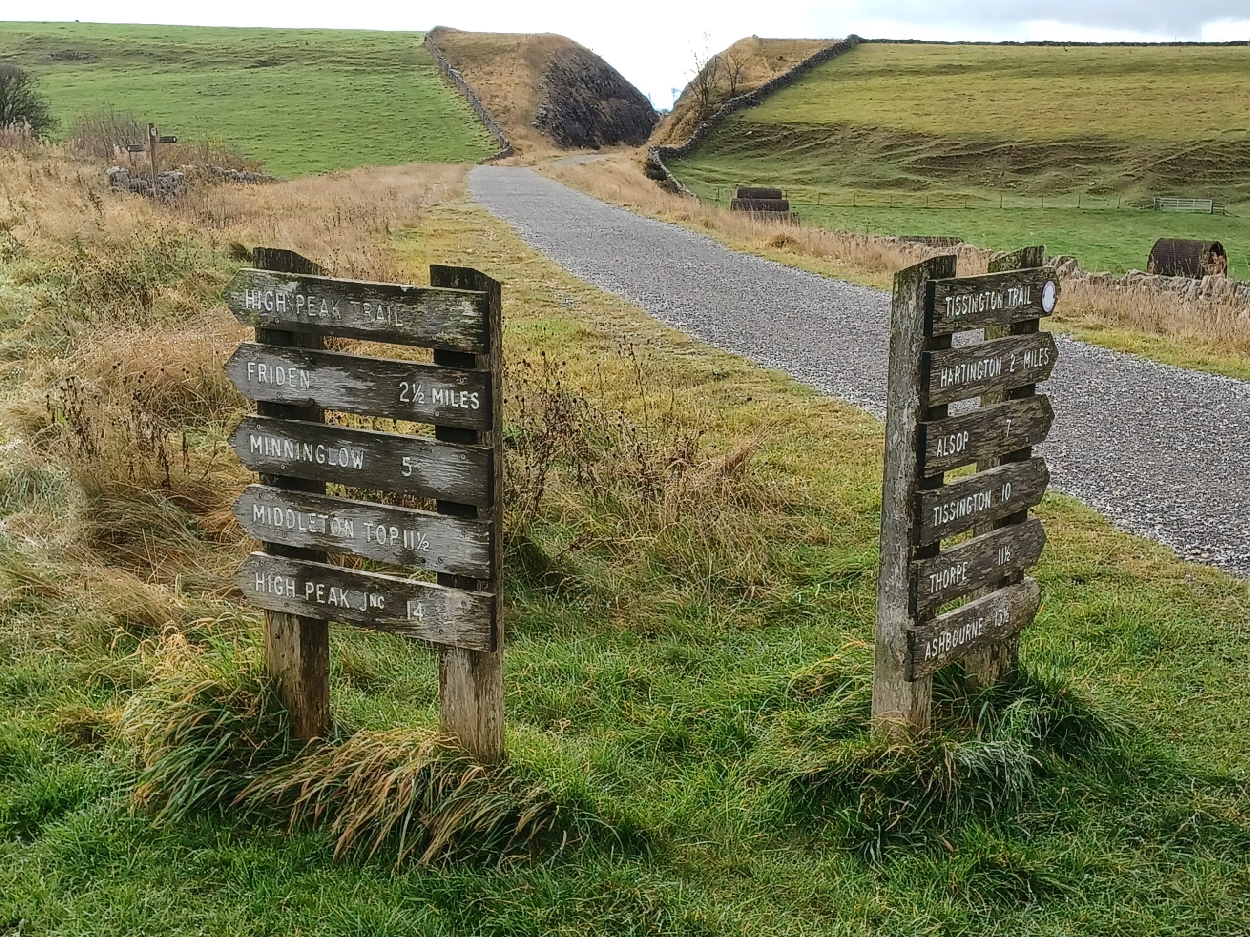
<figure class="post__image post__image--center"><img loading="lazy" src="https://railwaywalks.timholyoake.uk/media/posts/11/20241029_1034291-scaled.jpg" alt="Two signboards. On the left is the High Peak trail, on the right the Tissington Trail. The distances on the high peak trail (in miles) are Friden 2.5, Minninglow 5, Middleton Top 11.5, High Peak Junction 14. On the Tissington Trail, Hartington is 2 miles, Alsop 7, Tissington 10, Thorpe 11.5 and Ashbourne 13.5." width="2560" height="1920"  sizes="(max-width: 1920px) 100vw, 1920px" srcset="https://railwaywalks.timholyoake.uk/media/posts/11/responsive/20241029_1034291-scaled-xs.jpg 640w ,https://railwaywalks.timholyoake.uk/media/posts/11/responsive/20241029_1034291-scaled-sm.jpg 768w ,https://railwaywalks.timholyoake.uk/media/posts/11/responsive/20241029_1034291-scaled-md.jpg 1024w ,https://railwaywalks.timholyoake.uk/media/posts/11/responsive/20241029_1034291-scaled-lg.jpg 1366w ,https://railwaywalks.timholyoake.uk/media/posts/11/responsive/20241029_1034291-scaled-xl.jpg 1600w ,https://railwaywalks.timholyoake.uk/media/posts/11/responsive/20241029_1034291-scaled-2xl.jpg 1920w"><figcaption>Where next?</figcaption></figure>

&nbsp;

&nbsp;

&nbsp;
            ]]>
        </content>
    </entry>
    <entry>
        <title>Walk 9 - Ashbourne to Parsley Hay</title>
        <author>
            <name>tim</name>
        </author>
        <link href="https://railwaywalks.timholyoake.uk/walk9/"/>
        <id>https://railwaywalks.timholyoake.uk/walk9/</id>
        <media:content url="https://railwaywalks.timholyoake.uk/media/posts/10/20241017_130444-scaled.jpg" medium="image" />

        <updated>2024-10-18T10:39:00+01:00</updated>
            <summary type="html">
                <![CDATA[
                        <img src="https://railwaywalks.timholyoake.uk/media/posts/10/20241017_130444-scaled.jpg" alt="In the foreground is a typical station bench, with a Hartington sign. In the background is the preserved brown and cream Hartington signal box" />
                    Yesterday's walk was along the Tissington Trail. Opened in 1899, it was the last complete railway built in Derbyshire. Although Peak District tourists loved the line, the local population and businesses were too small to support it. By the mid 1950s scheduled passenger services were&hellip;
                ]]>
            </summary>
        <content type="html">
            <![CDATA[
                    <p><img src="https://railwaywalks.timholyoake.uk/media/posts/10/20241017_130444-scaled.jpg" class="type:primaryImage" alt="In the foreground is a typical station bench, with a Hartington sign. In the background is the preserved brown and cream Hartington signal box" /></p>
                Yesterday's walk was along the Tissington Trail. Opened in 1899, it was the last complete railway built in Derbyshire. Although Peak District tourists loved the line, the local population and businesses were too small to support it. By the mid 1950s scheduled passenger services were halted, with the line finally succumbing to Beeching's axe in 1967.

The round trip between Ashbourne and Parsley Hay is a little over 26 miles. A marathon! Needless to say I didn't walk ... I cycled instead. It's about 20 years since I last sat on a bike, let alone tried to ride one. After a very shaky start I rode around 300m before having to get off and push it down a steep slope to a bridge over a river. This was necessary as the viaduct that used to stand there collapsed in 1980 when undergoing maintenance.

<figure class="post__image post__image--center"><a href="https://railwaywalks.timholyoake.uk/wp-content/uploads/2024/10/Screenshot_20241018-102412.png"><img loading="lazy" src="https://railwaywalks.timholyoake.uk/media/posts/10/Screenshot_20241018-102412-e1729243906930.png" alt="A map, showing the route of the Tissington Trail between Ashbourne (bottom) and Parlsey Hay (top)." width="1190" height="1530"  sizes="(max-width: 1920px) 100vw, 1920px" srcset="https://railwaywalks.timholyoake.uk/media/posts/10/responsive/Screenshot_20241018-102412-e1729243906930-xs.png 640w ,https://railwaywalks.timholyoake.uk/media/posts/10/responsive/Screenshot_20241018-102412-e1729243906930-sm.png 768w ,https://railwaywalks.timholyoake.uk/media/posts/10/responsive/Screenshot_20241018-102412-e1729243906930-md.png 1024w ,https://railwaywalks.timholyoake.uk/media/posts/10/responsive/Screenshot_20241018-102412-e1729243906930-lg.png 1366w ,https://railwaywalks.timholyoake.uk/media/posts/10/responsive/Screenshot_20241018-102412-e1729243906930-xl.png 1600w ,https://railwaywalks.timholyoake.uk/media/posts/10/responsive/Screenshot_20241018-102412-e1729243906930-2xl.png 1920w"></a><figcaption>Yesterday's route</figcaption></figure>

The trail is uphill for the first 8 or 9 miles (albeit at a gentle gradient of about 1:100), so I stopped for refreshment at Tissington Station after half an hour. My arsenal (to quote my 'phones autocorrect) was already starting to hurt. There must be a better bike seat design somewhere, surely?!

The best views from the trail are between Tissington and Hartington. I was fortunate to have good weather. The day before, in torrential rain, the bike hire people had told me that the only sale they'd made was for a car parking season ticket.

<figure class="post__image post__image--center"><img loading="lazy" src="https://railwaywalks.timholyoake.uk/media/posts/10/20241017_113941-scaled.jpg" alt="Blue sky, white clouds and view over a rural landscape from the Tissington Trail" width="2560" height="1920"  sizes="(max-width: 1920px) 100vw, 1920px" srcset="https://railwaywalks.timholyoake.uk/media/posts/10/responsive/20241017_113941-scaled-xs.jpg 640w ,https://railwaywalks.timholyoake.uk/media/posts/10/responsive/20241017_113941-scaled-sm.jpg 768w ,https://railwaywalks.timholyoake.uk/media/posts/10/responsive/20241017_113941-scaled-md.jpg 1024w ,https://railwaywalks.timholyoake.uk/media/posts/10/responsive/20241017_113941-scaled-lg.jpg 1366w ,https://railwaywalks.timholyoake.uk/media/posts/10/responsive/20241017_113941-scaled-xl.jpg 1600w ,https://railwaywalks.timholyoake.uk/media/posts/10/responsive/20241017_113941-scaled-2xl.jpg 1920w"><figcaption>Big sky!</figcaption></figure>

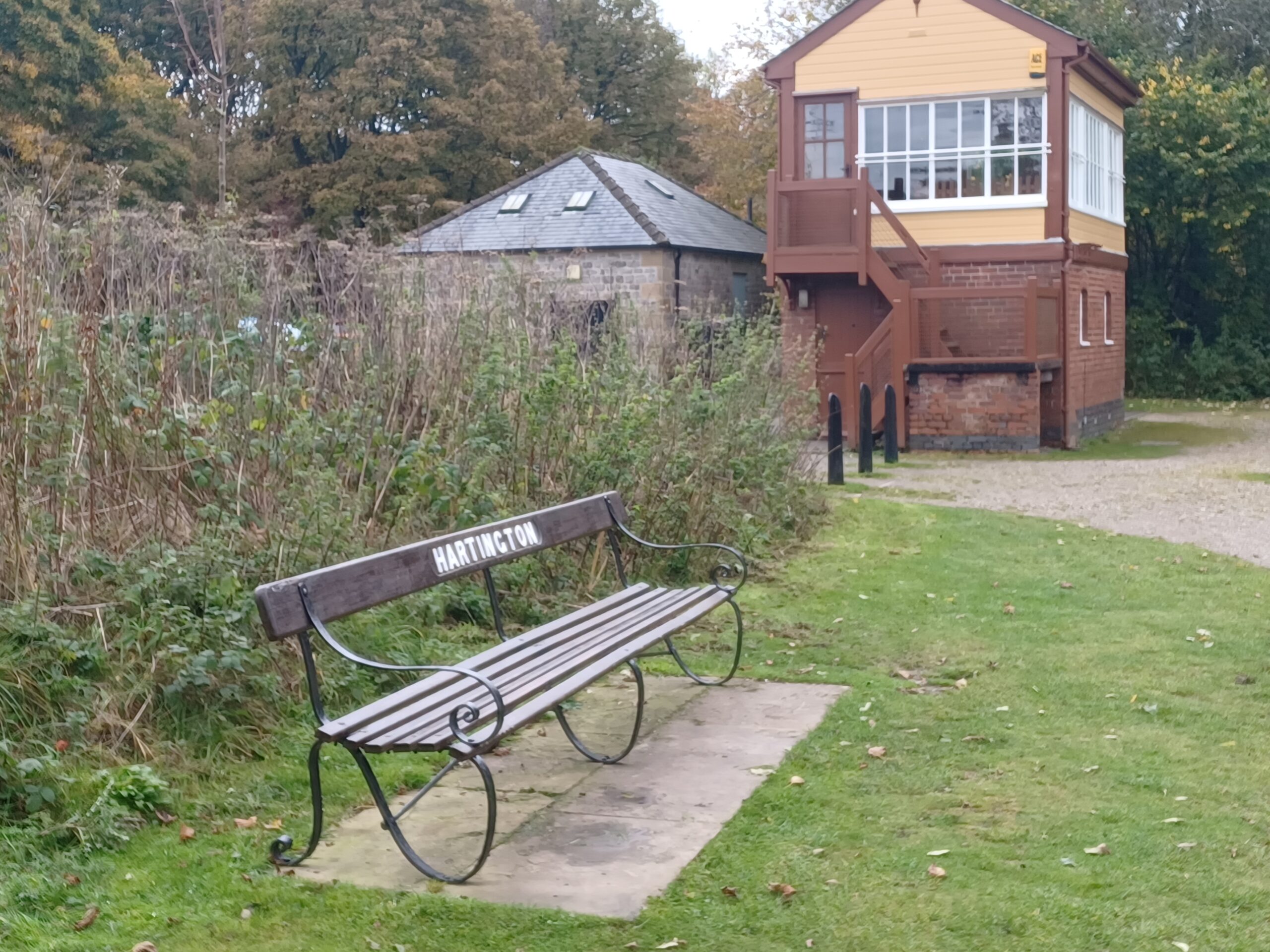
The cafe at the bottom of Hartington signal box was closed, but I was hopeful that two miles further along at Parsley Hay, refreshments would be available.

<figure class="post__image post__image--center"><img loading="lazy" src="https://railwaywalks.timholyoake.uk/media/posts/10/20241017_130444-scaled.jpg" alt="In the foreground is a typical station bench, with a Hartington sign. In the background is the preserved brown and cream Hartington signal box " width="2560" height="1920"  sizes="(max-width: 1920px) 100vw, 1920px" srcset="https://railwaywalks.timholyoake.uk/media/posts/10/responsive/20241017_130444-scaled-xs.jpg 640w ,https://railwaywalks.timholyoake.uk/media/posts/10/responsive/20241017_130444-scaled-sm.jpg 768w ,https://railwaywalks.timholyoake.uk/media/posts/10/responsive/20241017_130444-scaled-md.jpg 1024w ,https://railwaywalks.timholyoake.uk/media/posts/10/responsive/20241017_130444-scaled-lg.jpg 1366w ,https://railwaywalks.timholyoake.uk/media/posts/10/responsive/20241017_130444-scaled-xl.jpg 1600w ,https://railwaywalks.timholyoake.uk/media/posts/10/responsive/20241017_130444-scaled-2xl.jpg 1920w"><figcaption>Hartington Station and signal box</figcaption></figure>

It had taken me about 2 hours to reach Parsley Hay, where I was pleased to find more refreshments were indeed on offer. There's clearly something about cycling that makes me really hungry all of the time. The cafe had a glacially slow queue, but the gluten-free fruit toast was worth the wait.

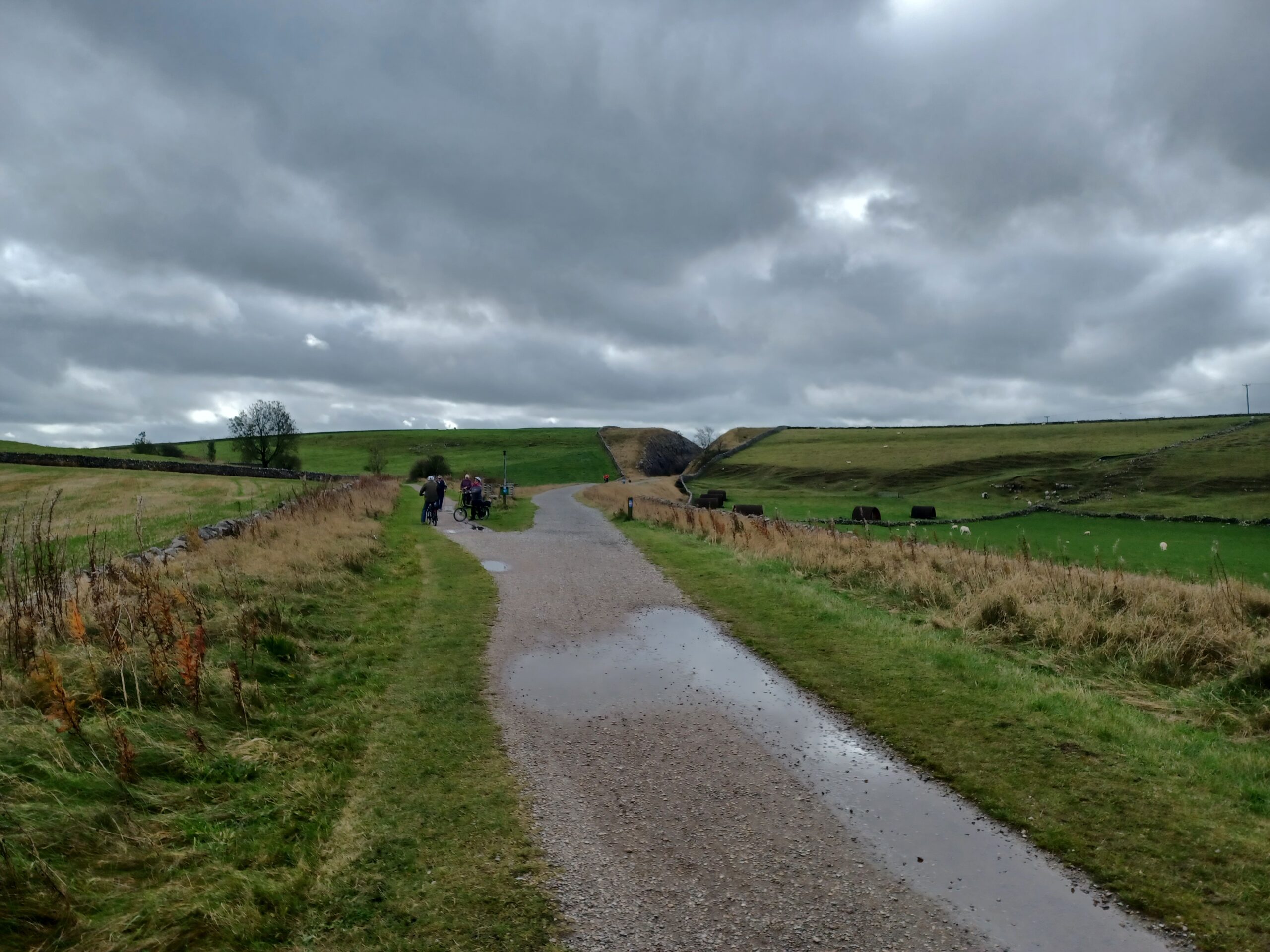
Heading back towards Ashbourne the weather changed. There are signs everywhere warning you that when the weather does change in the Peaks, it can do so both rapidly and lethally. I wasn't too worried as I had my waterproofs and some emergency rations (an elderflower drink in a Minion's bottle and a wagon wheel) but I was glad to be heading downhill.

<figure class="post__image post__image--center"><img loading="lazy" src="https://railwaywalks.timholyoake.uk/media/posts/10/20241017_125136-scaled.jpg" alt="To the right, the path heads to Ashbourne on the Tissington Trail. To the left, it heads down the High Peak trail to Middleton Top and High Peak Junction. The sky is covered in heavy grey clouds." width="2560" height="1920"  sizes="(max-width: 1920px) 100vw, 1920px" srcset="https://railwaywalks.timholyoake.uk/media/posts/10/responsive/20241017_125136-scaled-xs.jpg 640w ,https://railwaywalks.timholyoake.uk/media/posts/10/responsive/20241017_125136-scaled-sm.jpg 768w ,https://railwaywalks.timholyoake.uk/media/posts/10/responsive/20241017_125136-scaled-md.jpg 1024w ,https://railwaywalks.timholyoake.uk/media/posts/10/responsive/20241017_125136-scaled-lg.jpg 1366w ,https://railwaywalks.timholyoake.uk/media/posts/10/responsive/20241017_125136-scaled-xl.jpg 1600w ,https://railwaywalks.timholyoake.uk/media/posts/10/responsive/20241017_125136-scaled-2xl.jpg 1920w"><figcaption>High Peak Trail to the left, Tissington Trail to the right, south of Parsley Hay.</figcaption></figure>

By the time I'd reached Alsop en le Dale station the weather had improved. I decided to consume my emergency rations, figuring out that even if I got a puncture or the chain snapped, I could freewheel the bike back.

<figure class="post__image post__image--center"><img loading="lazy" src="https://railwaywalks.timholyoake.uk/media/posts/10/20241017_133756-scaled.jpg" alt="A wooden picnic table with a yellow water bottle and wagon wheel biscuit. A bike is propped up behind the table. " width="2560" height="1920"  sizes="(max-width: 1920px) 100vw, 1920px" srcset="https://railwaywalks.timholyoake.uk/media/posts/10/responsive/20241017_133756-scaled-xs.jpg 640w ,https://railwaywalks.timholyoake.uk/media/posts/10/responsive/20241017_133756-scaled-sm.jpg 768w ,https://railwaywalks.timholyoake.uk/media/posts/10/responsive/20241017_133756-scaled-md.jpg 1024w ,https://railwaywalks.timholyoake.uk/media/posts/10/responsive/20241017_133756-scaled-lg.jpg 1366w ,https://railwaywalks.timholyoake.uk/media/posts/10/responsive/20241017_133756-scaled-xl.jpg 1600w ,https://railwaywalks.timholyoake.uk/media/posts/10/responsive/20241017_133756-scaled-2xl.jpg 1920w"><figcaption>A trusty steed with my emergency rations</figcaption></figure>

Back in Ashbourne the sun was shining. I returned the bike and had a quick look at the tunnel that used to lead to the main station.

<figure class="post__image post__image--center"><img loading="lazy" src="https://railwaywalks.timholyoake.uk/media/posts/10/20241017_143059-scaled.jpg" alt="The entrance to a tunnel. There's a gate in front of it to stop motor vehicles travelling through it. The tunnel is dimly lit, with signs of moss and damp on the walls." width="2560" height="1920"  sizes="(max-width: 1920px) 100vw, 1920px" srcset="https://railwaywalks.timholyoake.uk/media/posts/10/responsive/20241017_143059-scaled-xs.jpg 640w ,https://railwaywalks.timholyoake.uk/media/posts/10/responsive/20241017_143059-scaled-sm.jpg 768w ,https://railwaywalks.timholyoake.uk/media/posts/10/responsive/20241017_143059-scaled-md.jpg 1024w ,https://railwaywalks.timholyoake.uk/media/posts/10/responsive/20241017_143059-scaled-lg.jpg 1366w ,https://railwaywalks.timholyoake.uk/media/posts/10/responsive/20241017_143059-scaled-xl.jpg 1600w ,https://railwaywalks.timholyoake.uk/media/posts/10/responsive/20241017_143059-scaled-2xl.jpg 1920w"><figcaption>The Northern portal of the tunnel to Ashbourne</figcaption></figure>

My sore arsenal testifies that I rode 41.86km in 3hrs 34m 26s at an average speed of 11.7 km/h.

If you enjoyed reading this, <a href="https://www.justgiving.com/page/derbyshire-railway-trails-walk">please consider making a donation to Lymphoma Action</a>. Thank you for your support!
            ]]>
        </content>
    </entry>
    <entry>
        <title>Walk 8 - Brierley Forest Park to Tibshelf</title>
        <author>
            <name>tim</name>
        </author>
        <link href="https://railwaywalks.timholyoake.uk/walk8/"/>
        <id>https://railwaywalks.timholyoake.uk/walk8/</id>
        <media:content url="https://railwaywalks.timholyoake.uk/media/posts/9/20241010_1052191-scaled.jpg" medium="image" />

        <updated>2024-10-11T10:54:45+01:00</updated>
            <summary type="html">
                <![CDATA[
                        <img src="https://railwaywalks.timholyoake.uk/media/posts/9/20241010_1052191-scaled.jpg" alt="On the right there is an old red and white railway signal, raised. on the left there is a wooden post, marking the boundary between Nottinghamshire and Derbyshire." />
                    Yesterday's walk started at Brierley Forest Park (on the site of the former Sutton Colliery) and took in two of the Phoenix Greenways - the Brierley Branch and Silverhill Trail - en-route to just west of Tibshelf. There's a visitor centre at the start. From&hellip;
                ]]>
            </summary>
        <content type="html">
            <![CDATA[
                    <p><img src="https://railwaywalks.timholyoake.uk/media/posts/9/20241010_1052191-scaled.jpg" class="type:primaryImage" alt="On the right there is an old red and white railway signal, raised. on the left there is a wooden post, marking the boundary between Nottinghamshire and Derbyshire." /></p>
                Yesterday's walk started at Brierley Forest Park (on the site of the former Sutton Colliery) and took in two of the Phoenix Greenways - the Brierley Branch and Silverhill Trail - en-route to just west of Tibshelf. There's a visitor centre at the start. From the outside it looked as if it was shut (the glass doors of the main entrance need a really good clean) but once inside there's a lively and rather good cafe (large bacon cobs at just £3.65 - a bargain).

My first job was to find the start of the trail. While there's some cursory signage indicating a number of walking routes in the park (and some faded printouts of maps on the dirty windows of the visitor centre), it's difficult to figure out how to find the Brierley Branch trail. I eventually stumbled across it at the Eastern end of the park.

Yesterday was cold and cloudy and there were few around (in the three hours I spent walking I doubt I saw more than three dozen people), but they were all aware of <a href="https://railwaywalks.timholyoake.uk/walk5/">Holyoake’s Railway Walks Theory</a>. I was called 'duck' at least four times, maybe more. It was wonderful.

<figure class="post__image post__image--center"><img loading="lazy" src="https://railwaywalks.timholyoake.uk/media/posts/9/2024-10-11-094553_1920x1080_scrot.png" alt="The section around Sutton in Ashfield and Tibshelf of the OS sheet 112 (Nottingham), 7th series, 1960. One inch to the mile. Reproduced with the permission of the National Library of Scotland. My route is marked in blue, taking in the Brierley Forest Park, Brierley Branch and Silverhill trails." width="1461" height="607"  sizes="(max-width: 1920px) 100vw, 1920px" srcset="https://railwaywalks.timholyoake.uk/media/posts/9/responsive/2024-10-11-094553_1920x1080_scrot-xs.png 640w ,https://railwaywalks.timholyoake.uk/media/posts/9/responsive/2024-10-11-094553_1920x1080_scrot-sm.png 768w ,https://railwaywalks.timholyoake.uk/media/posts/9/responsive/2024-10-11-094553_1920x1080_scrot-md.png 1024w ,https://railwaywalks.timholyoake.uk/media/posts/9/responsive/2024-10-11-094553_1920x1080_scrot-lg.png 1366w ,https://railwaywalks.timholyoake.uk/media/posts/9/responsive/2024-10-11-094553_1920x1080_scrot-xl.png 1600w ,https://railwaywalks.timholyoake.uk/media/posts/9/responsive/2024-10-11-094553_1920x1080_scrot-2xl.png 1920w"><figcaption>OS sheet 112 (Nottingham), 7th series, 1960. One inch to the mile. Reproduced with the permission of the National Library of Scotland.</figcaption></figure>

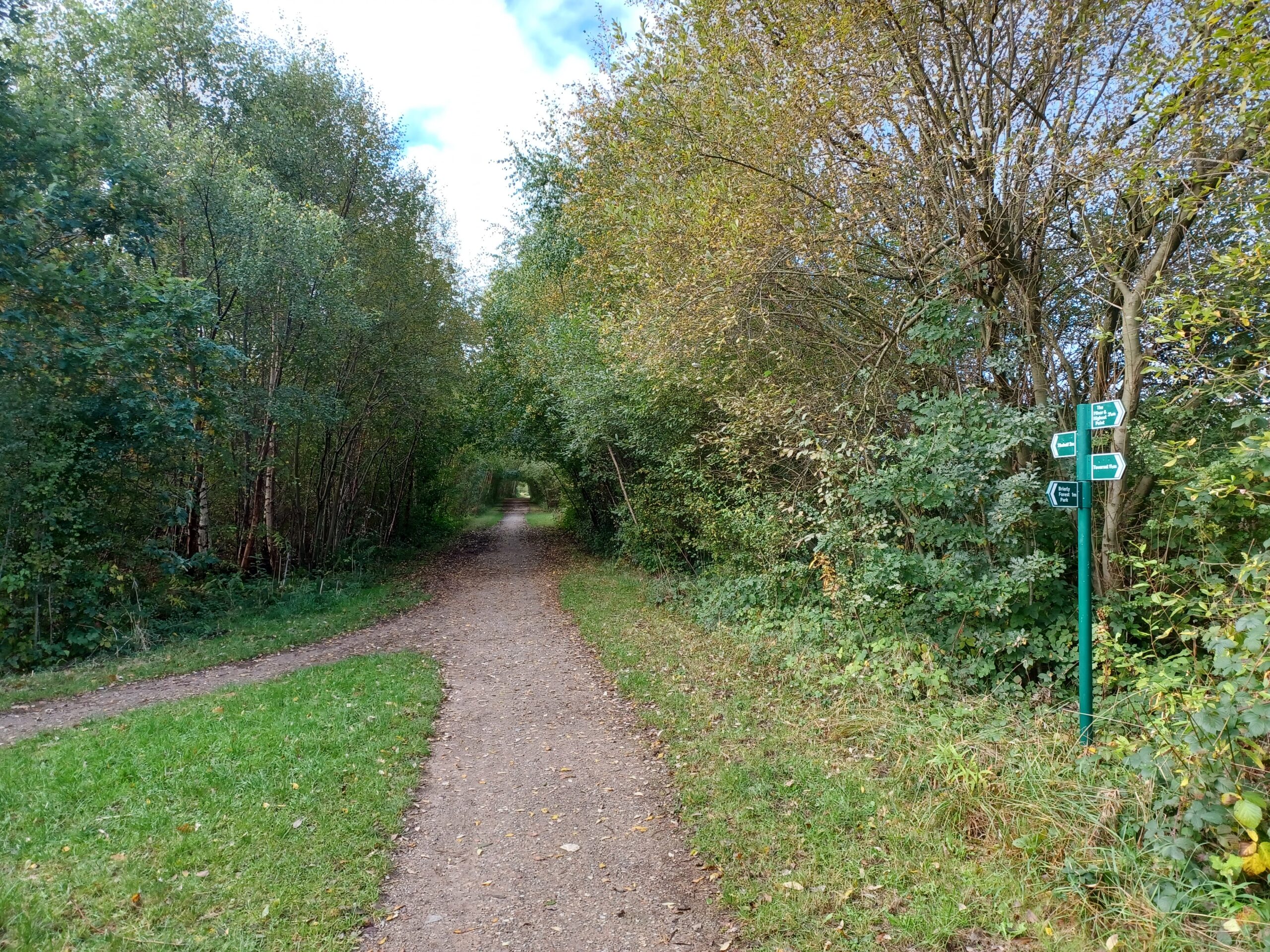
There's really not very much to report about the Brierley Branch. It's a bridleway that passes farmland and a golf course and that's pretty much it. After a mile or so of walking it meets up with the Silverhill Trail. I turn left towards Tibshelf rather than right to Teversal, as I need to head into Derbyshire.

<figure class="post__image post__image--center"><img loading="lazy" src="https://railwaywalks.timholyoake.uk/media/posts/9/20241010_1042561-scaled.jpg" alt="A footpath - the Silverhill trail - heading into the distance through trees just starting to get their autumn colours." width="2560" height="1920"  sizes="(max-width: 1920px) 100vw, 1920px" srcset="https://railwaywalks.timholyoake.uk/media/posts/9/responsive/20241010_1042561-scaled-xs.jpg 640w ,https://railwaywalks.timholyoake.uk/media/posts/9/responsive/20241010_1042561-scaled-sm.jpg 768w ,https://railwaywalks.timholyoake.uk/media/posts/9/responsive/20241010_1042561-scaled-md.jpg 1024w ,https://railwaywalks.timholyoake.uk/media/posts/9/responsive/20241010_1042561-scaled-lg.jpg 1366w ,https://railwaywalks.timholyoake.uk/media/posts/9/responsive/20241010_1042561-scaled-xl.jpg 1600w ,https://railwaywalks.timholyoake.uk/media/posts/9/responsive/20241010_1042561-scaled-2xl.jpg 1920w"><figcaption>The junction of the Silverhill Trail with the Brierley Branch (joining from the left)</figcaption></figure>

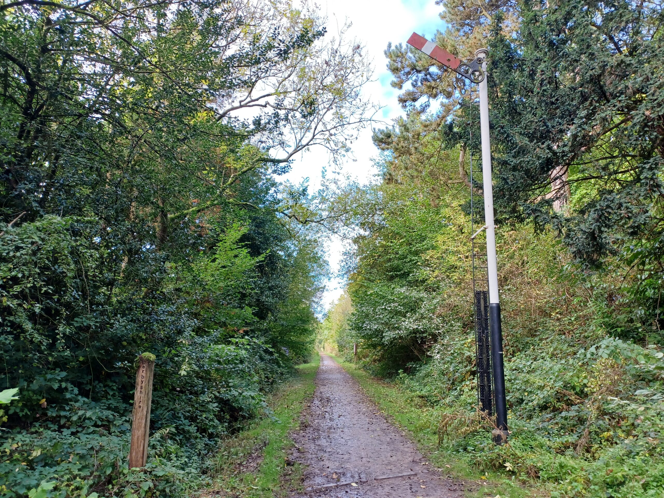
The Nottinghamshire / Derbyshire boundary is at Woodend, marked by an old railway signal and a wooden post.

<figure class="post__image post__image--center"><img loading="lazy" src="https://railwaywalks.timholyoake.uk/media/posts/9/20241010_1052191-scaled.jpg" alt="On the right there is an old red and white railway signal, raised. on the left there is a wooden post, marking the boundary between Nottinghamshire and Derbyshire." width="2560" height="1920"  sizes="(max-width: 1920px) 100vw, 1920px" srcset="https://railwaywalks.timholyoake.uk/media/posts/9/responsive/20241010_1052191-scaled-xs.jpg 640w ,https://railwaywalks.timholyoake.uk/media/posts/9/responsive/20241010_1052191-scaled-sm.jpg 768w ,https://railwaywalks.timholyoake.uk/media/posts/9/responsive/20241010_1052191-scaled-md.jpg 1024w ,https://railwaywalks.timholyoake.uk/media/posts/9/responsive/20241010_1052191-scaled-lg.jpg 1366w ,https://railwaywalks.timholyoake.uk/media/posts/9/responsive/20241010_1052191-scaled-xl.jpg 1600w ,https://railwaywalks.timholyoake.uk/media/posts/9/responsive/20241010_1052191-scaled-2xl.jpg 1920w"><figcaption>The Nottinghamshire / Derbyshire boundary on the Silverhill Trail.</figcaption></figure>

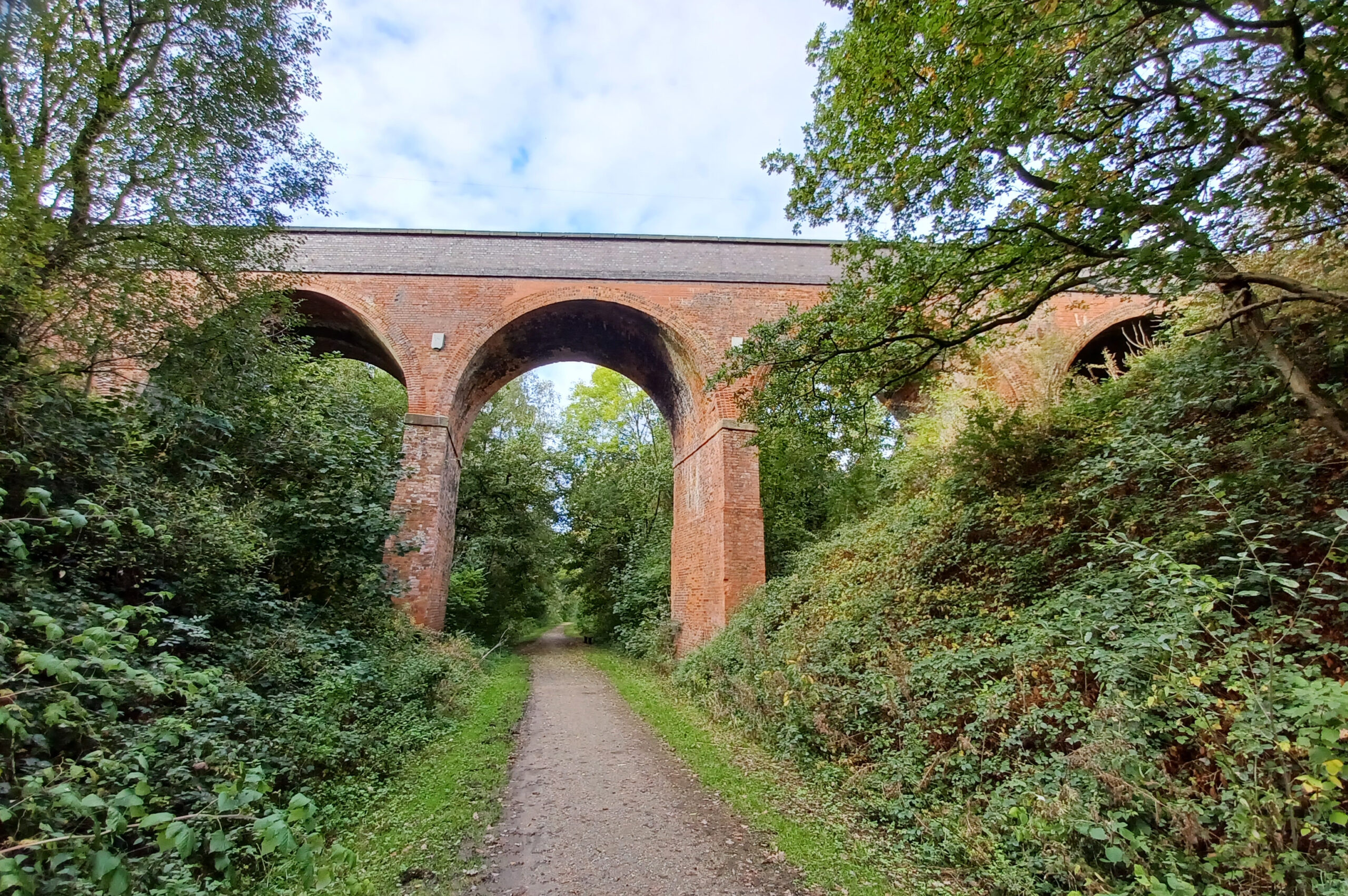
There's a concrete tunnel, heavily laden with graffiti, that passes under the M1. This abomination is immediately followed by a spectacular brick viaduct carrying a 'B' road across the trail. There are bat boxes high up on the arches.

<figure class="post__image post__image--center"><img loading="lazy" src="https://railwaywalks.timholyoake.uk/media/posts/9/20241010_110723-scaled.jpg" alt="A brick viaduct crossing the trail. There are four arches visible." width="2560" height="1702"  sizes="(max-width: 1920px) 100vw, 1920px" srcset="https://railwaywalks.timholyoake.uk/media/posts/9/responsive/20241010_110723-scaled-xs.jpg 640w ,https://railwaywalks.timholyoake.uk/media/posts/9/responsive/20241010_110723-scaled-sm.jpg 768w ,https://railwaywalks.timholyoake.uk/media/posts/9/responsive/20241010_110723-scaled-md.jpg 1024w ,https://railwaywalks.timholyoake.uk/media/posts/9/responsive/20241010_110723-scaled-lg.jpg 1366w ,https://railwaywalks.timholyoake.uk/media/posts/9/responsive/20241010_110723-scaled-xl.jpg 1600w ,https://railwaywalks.timholyoake.uk/media/posts/9/responsive/20241010_110723-scaled-2xl.jpg 1920w"><figcaption>A brick viaduct on the Silverhill Trail near Tibshelf</figcaption></figure>

I carried on to the end of the trail. Originally this was a branch line serving the local villages and collieries and it would have met the Midland Mainline a few hundred metres away from where this photograph was taken.

<figure class="post__image post__image--center"><img loading="lazy" src="https://railwaywalks.timholyoake.uk/media/posts/9/20241010_1137531-scaled.jpg" alt="The Derbyshire end of the Silverhill trail. There are some old railway lines in the foreground leading to a metal gate onto the greenway." width="2560" height="1920"  sizes="(max-width: 1920px) 100vw, 1920px" srcset="https://railwaywalks.timholyoake.uk/media/posts/9/responsive/20241010_1137531-scaled-xs.jpg 640w ,https://railwaywalks.timholyoake.uk/media/posts/9/responsive/20241010_1137531-scaled-sm.jpg 768w ,https://railwaywalks.timholyoake.uk/media/posts/9/responsive/20241010_1137531-scaled-md.jpg 1024w ,https://railwaywalks.timholyoake.uk/media/posts/9/responsive/20241010_1137531-scaled-lg.jpg 1366w ,https://railwaywalks.timholyoake.uk/media/posts/9/responsive/20241010_1137531-scaled-xl.jpg 1600w ,https://railwaywalks.timholyoake.uk/media/posts/9/responsive/20241010_1137531-scaled-2xl.jpg 1920w"><figcaption>The end of the line. 13.01km, 16,786 steps, 2 hours, 52 minutes, 51 seconds.</figcaption></figure>

I was expecting notices banning any further progress, but there's a farm track following parallel to the old railway that takes you almost onto the Midland Mainline. I didn't explore it though and headed back to my start point.

As I was bored with the Brierley Branch, I followed the footpath up Herrod's Hill back to the visitor centre. It passes through a golf course - but apart from a groundskeeper mowing the lawns where people with golf bats hit balls there was no-one around.

Driving back through Huthwaite I notice that the town already has Christmas decorations up on the lamposts.

If you enjoyed reading this, <a href="https://www.justgiving.com/page/derbyshire-railway-trails-walk">please consider making a donation to Lymphoma Action</a>. Thank you for your support!
            ]]>
        </content>
    </entry>
    <entry>
        <title>Walk 7 - Middleton Top to Hopton Top</title>
        <author>
            <name>tim</name>
        </author>
        <link href="https://railwaywalks.timholyoake.uk/walk7/"/>
        <id>https://railwaywalks.timholyoake.uk/walk7/</id>
        <media:content url="https://railwaywalks.timholyoake.uk/media/posts/8/20241007_121754-scaled.jpg" medium="image" />

        <updated>2024-10-08T09:38:13+01:00</updated>
            <summary type="html">
                <![CDATA[
                        <img src="https://railwaywalks.timholyoake.uk/media/posts/8/20241007_121754-scaled.jpg" alt="Five wind turbines against a cloudy grey sky. In the left hand side background you can just make out Carsington Water." />
                    Yesterday's walk followed a circular route around Middleton Top, Middleton Moor and Hopton Top, so only the last couple of kilometres followed the High Peak Trail. I had a special guest with me yesterday to guide me through the cow and sheep dung and to&hellip;
                ]]>
            </summary>
        <content type="html">
            <![CDATA[
                    <p><img src="https://railwaywalks.timholyoake.uk/media/posts/8/20241007_121754-scaled.jpg" class="type:primaryImage" alt="Five wind turbines against a cloudy grey sky. In the left hand side background you can just make out Carsington Water." /></p>
                Yesterday's walk followed a circular route around Middleton Top, Middleton Moor and Hopton Top, so only the last couple of kilometres followed the High Peak Trail. I had a special guest with me yesterday to guide me through the cow and sheep dung and to make sure that I didn't wander off the path to my certain death by exposure, plunging down a disused lead mine shaft or into a long abandoned quarry. Look at the map from 1884 and you'll see what I mean ...

<figure class="post__image post__image--center"><img loading="lazy" src="https://railwaywalks.timholyoake.uk/media/posts/8/2024-10-08-085112_1920x1080_scrot.png" alt="An 1884 OS map of Hopton and Middleton. The route of this walk is marked in blue." width="1602" height="648"  sizes="(max-width: 1920px) 100vw, 1920px" srcset="https://railwaywalks.timholyoake.uk/media/posts/8/responsive/2024-10-08-085112_1920x1080_scrot-xs.png 640w ,https://railwaywalks.timholyoake.uk/media/posts/8/responsive/2024-10-08-085112_1920x1080_scrot-sm.png 768w ,https://railwaywalks.timholyoake.uk/media/posts/8/responsive/2024-10-08-085112_1920x1080_scrot-md.png 1024w ,https://railwaywalks.timholyoake.uk/media/posts/8/responsive/2024-10-08-085112_1920x1080_scrot-lg.png 1366w ,https://railwaywalks.timholyoake.uk/media/posts/8/responsive/2024-10-08-085112_1920x1080_scrot-xl.png 1600w ,https://railwaywalks.timholyoake.uk/media/posts/8/responsive/2024-10-08-085112_1920x1080_scrot-2xl.png 1920w"><figcaption>An 1884 OS map of Hopton and Middleton Moor. Reproduced with the permission of the National Library of Scotland.</figcaption></figure>

Setting off from the Engine House at Middleton Top (this is where <a href="https://railwaywalks.timholyoake.uk/walk3/">walk 3</a> finished), we headed up the footpath towards Middleton Moor. On a clear day there are fantastic views towards Derby from here, but the gloom and murk yesterday morning made them far less attractive. From there we skirted around old mine workings and quarries to reach an abandoned (but recently purchased) set of farm buildings at Intake Barn. It's possible to cut back to the High Peak Trail from here, but we carried on towards the site of the old tramway bridge near Armlees. It's very well preserved - probably due to the immense care that seems to have been taken when it was built. Here's Jane pointing out the finer details of its construction for you.

<figure class="post__image post__image--center"><img loading="lazy" src="https://railwaywalks.timholyoake.uk/media/posts/8/20241007_113103-scaled.jpg" alt="Jane, dressed in pink trousers and a red/black waterproof, pointing to some architectural detail under the stome tramway bridge near Armlees, Derbyshire. She's using a walking stick to do this." width="2560" height="1920"  sizes="(max-width: 1920px) 100vw, 1920px" srcset="https://railwaywalks.timholyoake.uk/media/posts/8/responsive/20241007_113103-scaled-xs.jpg 640w ,https://railwaywalks.timholyoake.uk/media/posts/8/responsive/20241007_113103-scaled-sm.jpg 768w ,https://railwaywalks.timholyoake.uk/media/posts/8/responsive/20241007_113103-scaled-md.jpg 1024w ,https://railwaywalks.timholyoake.uk/media/posts/8/responsive/20241007_113103-scaled-lg.jpg 1366w ,https://railwaywalks.timholyoake.uk/media/posts/8/responsive/20241007_113103-scaled-xl.jpg 1600w ,https://railwaywalks.timholyoake.uk/media/posts/8/responsive/20241007_113103-scaled-2xl.jpg 1920w"><figcaption>Jane under the tramway bridge near Armlees.</figcaption></figure>

Approaching Chariot Woods there was a planning notice on the footpath dated February, saying that the owner wanted to divert it away from the dangerous quarry edge. We took the notice at face value and followed the proposed diversion, only to find that it hadn't been finished (or even started). We ended up in a field of rather confused sheep and climbing over a locked gate to regain the route.

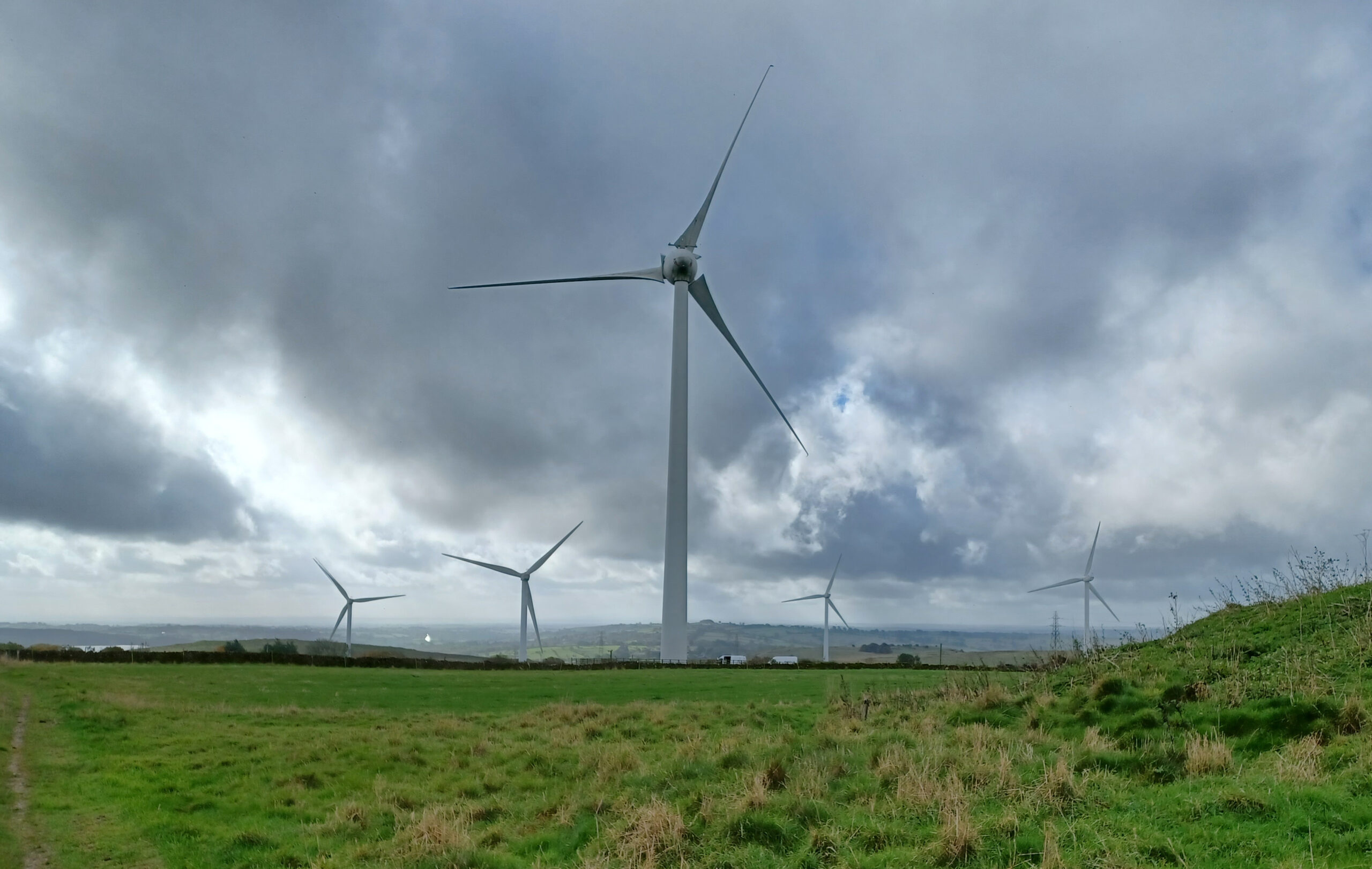
A little further along there's a view towards Carsington Water framed by some majestic wind turbines.

<figure class="post__image post__image--center"><img loading="lazy" src="https://railwaywalks.timholyoake.uk/media/posts/8/20241007_121754-scaled.jpg" alt="Five wind turbines against a cloudy grey sky. In the left hand side background you can just make out Carsington Water." width="2560" height="1622"  sizes="(max-width: 1920px) 100vw, 1920px" srcset="https://railwaywalks.timholyoake.uk/media/posts/8/responsive/20241007_121754-scaled-xs.jpg 640w ,https://railwaywalks.timholyoake.uk/media/posts/8/responsive/20241007_121754-scaled-sm.jpg 768w ,https://railwaywalks.timholyoake.uk/media/posts/8/responsive/20241007_121754-scaled-md.jpg 1024w ,https://railwaywalks.timholyoake.uk/media/posts/8/responsive/20241007_121754-scaled-lg.jpg 1366w ,https://railwaywalks.timholyoake.uk/media/posts/8/responsive/20241007_121754-scaled-xl.jpg 1600w ,https://railwaywalks.timholyoake.uk/media/posts/8/responsive/20241007_121754-scaled-2xl.jpg 1920w"><figcaption>Wind Turbines next to Chariot Woods.</figcaption></figure>

The weather still looked rather threatening, so we headed down the hill to join the High Peak Trail. We arrived at a former railway building, converted into a holiday let, just before the start of the Hopton Incline. This incline is mild (compared to the ones I tackled earlier in September) at 1 in 14, and we were walking down it. It used to be the steepest incline on the British Railways network that trains tackled 'under their own steam'. I can't imagine it was very easy in bad weather ... or even in the reasonably good weather we now had as the sun had finally appeared.

<figure class="post__image post__image--center"><img loading="lazy" src="https://railwaywalks.timholyoake.uk/media/posts/8/20241007_122851-scaled.jpg" alt="A former railway building, now a holiday let, at the top of the Hopton Incline. There's a board in front of the house that explains the history of the site." width="2560" height="1626"  sizes="(max-width: 1920px) 100vw, 1920px" srcset="https://railwaywalks.timholyoake.uk/media/posts/8/responsive/20241007_122851-scaled-xs.jpg 640w ,https://railwaywalks.timholyoake.uk/media/posts/8/responsive/20241007_122851-scaled-sm.jpg 768w ,https://railwaywalks.timholyoake.uk/media/posts/8/responsive/20241007_122851-scaled-md.jpg 1024w ,https://railwaywalks.timholyoake.uk/media/posts/8/responsive/20241007_122851-scaled-lg.jpg 1366w ,https://railwaywalks.timholyoake.uk/media/posts/8/responsive/20241007_122851-scaled-xl.jpg 1600w ,https://railwaywalks.timholyoake.uk/media/posts/8/responsive/20241007_122851-scaled-2xl.jpg 1920w"><figcaption>At the top of the Hopton Incline</figcaption></figure>

We headed down the incline, through the Hopton Tunnel and back to the visitor centre at Middleton Top. Walk finished - 7.03km, 10,285 steps, 2 hours, 22 minutes, 51 seconds.

If you enjoyed reading this, <a href="https://www.justgiving.com/page/derbyshire-railway-trails-walk">please consider making a donation to Lymphoma Action</a>. Thank you for your support!
            ]]>
        </content>
    </entry>
    <entry>
        <title>Walk 6 - Monsal Head to Wyedale</title>
        <author>
            <name>tim</name>
        </author>
        <link href="https://railwaywalks.timholyoake.uk/walk6/"/>
        <id>https://railwaywalks.timholyoake.uk/walk6/</id>
        <media:content url="https://railwaywalks.timholyoake.uk/media/posts/7/20241004_130059-scaled.jpg" medium="image" />

        <updated>2024-10-05T10:38:44+01:00</updated>
            <summary type="html">
                <![CDATA[
                        <img src="https://railwaywalks.timholyoake.uk/media/posts/7/20241004_130059-scaled.jpg" alt="The view towards Cressbrook Mill taken from the Monsal Trail" />
                    Yesterday I returned to walking after my hiatus due to holiday. This route completes the second half of the Monsal Trail between Monsal Head and Wyedale. The National Library of Scotland have a beautiful map from 1899 showing the parish boundaries in colour - my&hellip;
                ]]>
            </summary>
        <content type="html">
            <![CDATA[
                    <p><img src="https://railwaywalks.timholyoake.uk/media/posts/7/20241004_130059-scaled.jpg" class="type:primaryImage" alt="The view towards Cressbrook Mill taken from the Monsal Trail" /></p>
                Yesterday I returned to walking after my hiatus due to holiday. This route completes the second half of the Monsal Trail between Monsal Head and Wyedale. The National Library of Scotland have a beautiful map from 1899 showing the parish boundaries in colour - my route (in orange) passed through five.

<figure class="post__image post__image--center"><img loading="lazy" src="https://railwaywalks.timholyoake.uk/media/posts/7/2024-10-04-181755_1920x1080_scrot.png" alt="OS map from 1899 showing parish boundaries in colour. The route of my walk is shown as an orange line and passes through 6 different parishes" width="1656" height="670"  sizes="(max-width: 1920px) 100vw, 1920px" srcset="https://railwaywalks.timholyoake.uk/media/posts/7/responsive/2024-10-04-181755_1920x1080_scrot-xs.png 640w ,https://railwaywalks.timholyoake.uk/media/posts/7/responsive/2024-10-04-181755_1920x1080_scrot-sm.png 768w ,https://railwaywalks.timholyoake.uk/media/posts/7/responsive/2024-10-04-181755_1920x1080_scrot-md.png 1024w ,https://railwaywalks.timholyoake.uk/media/posts/7/responsive/2024-10-04-181755_1920x1080_scrot-lg.png 1366w ,https://railwaywalks.timholyoake.uk/media/posts/7/responsive/2024-10-04-181755_1920x1080_scrot-xl.png 1600w ,https://railwaywalks.timholyoake.uk/media/posts/7/responsive/2024-10-04-181755_1920x1080_scrot-2xl.png 1920w"><figcaption>Today’s route on a 1899 OS map showing the parish boundaries. Reproduced with the permission of the National Library of Scotland.</figcaption></figure>

Like <a href="https://railwaywalks.timholyoake.uk/walk5/">walk 5</a>, I started roughly in the middle (for parking and refreshment reasons) at the enormous Miller's Dale station. National Highways are currently carrying out repairs to the (closed) second viaduct at the station (built 1904) but everything else is open as usual. After spending the last couple of weeks in Spain the sunny weather was welcome - but it felt really cold!

<figure class="post__image post__image--center"><img loading="lazy" src="https://railwaywalks.timholyoake.uk/media/posts/7/20241004_105140-scaled.jpg" alt="Miller's Dale station in bright early October sunlight" width="2560" height="1920"  sizes="(max-width: 1920px) 100vw, 1920px" srcset="https://railwaywalks.timholyoake.uk/media/posts/7/responsive/20241004_105140-scaled-xs.jpg 640w ,https://railwaywalks.timholyoake.uk/media/posts/7/responsive/20241004_105140-scaled-sm.jpg 768w ,https://railwaywalks.timholyoake.uk/media/posts/7/responsive/20241004_105140-scaled-md.jpg 1024w ,https://railwaywalks.timholyoake.uk/media/posts/7/responsive/20241004_105140-scaled-lg.jpg 1366w ,https://railwaywalks.timholyoake.uk/media/posts/7/responsive/20241004_105140-scaled-xl.jpg 1600w ,https://railwaywalks.timholyoake.uk/media/posts/7/responsive/20241004_105140-scaled-2xl.jpg 1920w"><figcaption>Millers Dale Station</figcaption></figure>

Setting off, I headed West towards Wyedale. There are three tunnels on this stretch of the route. The first is the longest - Chee Tor Tunnel (366 metres). It's built in the same way as the Headstone Tunnel from walk 5 and is equally impressive. A short bridge separates this tunnel from Chee Tor No.2 Tunnel (a tiddler at just 86m).

<figure class="post__image post__image--center"><img loading="lazy" src="https://railwaywalks.timholyoake.uk/media/posts/7/20241004_110325-scaled.jpg" alt="Chee Tor Tunnel entrance. The sign on the left hand side warns you not to touch the walls." width="2560" height="1920"  sizes="(max-width: 1920px) 100vw, 1920px" srcset="https://railwaywalks.timholyoake.uk/media/posts/7/responsive/20241004_110325-scaled-xs.jpg 640w ,https://railwaywalks.timholyoake.uk/media/posts/7/responsive/20241004_110325-scaled-sm.jpg 768w ,https://railwaywalks.timholyoake.uk/media/posts/7/responsive/20241004_110325-scaled-md.jpg 1024w ,https://railwaywalks.timholyoake.uk/media/posts/7/responsive/20241004_110325-scaled-lg.jpg 1366w ,https://railwaywalks.timholyoake.uk/media/posts/7/responsive/20241004_110325-scaled-xl.jpg 1600w ,https://railwaywalks.timholyoake.uk/media/posts/7/responsive/20241004_110325-scaled-2xl.jpg 1920w"><figcaption>Chee Tor Tunnel</figcaption></figure>

A little further along and I found the third tunnel at Rusher Cutting. This one is also short by Monsal Trail standards, but seems to be built differently to all of the others. The sides of the tunnel are cylindrical, whereas all of the other tunnels have vertical sides that slope slightly outwards to meet the roof. I'm sure there's an explanation why it's different, but I haven't found it.

<figure class="post__image post__image--center"><img loading="lazy" src="https://railwaywalks.timholyoake.uk/media/posts/7/20241004_113715-scaled.jpg" alt="Rusher Cutting Tunnel" width="2560" height="1920"  sizes="(max-width: 1920px) 100vw, 1920px" srcset="https://railwaywalks.timholyoake.uk/media/posts/7/responsive/20241004_113715-scaled-xs.jpg 640w ,https://railwaywalks.timholyoake.uk/media/posts/7/responsive/20241004_113715-scaled-sm.jpg 768w ,https://railwaywalks.timholyoake.uk/media/posts/7/responsive/20241004_113715-scaled-md.jpg 1024w ,https://railwaywalks.timholyoake.uk/media/posts/7/responsive/20241004_113715-scaled-lg.jpg 1366w ,https://railwaywalks.timholyoake.uk/media/posts/7/responsive/20241004_113715-scaled-xl.jpg 1600w ,https://railwaywalks.timholyoake.uk/media/posts/7/responsive/20241004_113715-scaled-2xl.jpg 1920w"><figcaption>Rusher Cutting Tunnel</figcaption></figure>

Just before the end of the trail at Wyedale there's a fork to the right (onto another disused line that you can see on the 1899 map) that joins the Pennine Bridleway. At Wyedale there's an end of trail marker, a notice announcing that the cycle hire and refreshment kiosk are closed until spring 2025 and strict instructions not to try to follow the route of the old railway any further.

<figure class="post__image post__image--center"><img loading="lazy" src="https://railwaywalks.timholyoake.uk/media/posts/7/20241004_112434-scaled.jpg" alt="The end of the Monsal Trail at Wyedale. There's no sign of any trains after the gate, but I'm not going to risk a £1,000 fine." width="2560" height="1920"  sizes="(max-width: 1920px) 100vw, 1920px" srcset="https://railwaywalks.timholyoake.uk/media/posts/7/responsive/20241004_112434-scaled-xs.jpg 640w ,https://railwaywalks.timholyoake.uk/media/posts/7/responsive/20241004_112434-scaled-sm.jpg 768w ,https://railwaywalks.timholyoake.uk/media/posts/7/responsive/20241004_112434-scaled-md.jpg 1024w ,https://railwaywalks.timholyoake.uk/media/posts/7/responsive/20241004_112434-scaled-lg.jpg 1366w ,https://railwaywalks.timholyoake.uk/media/posts/7/responsive/20241004_112434-scaled-xl.jpg 1600w ,https://railwaywalks.timholyoake.uk/media/posts/7/responsive/20241004_112434-scaled-2xl.jpg 1920w"><figcaption>The end of the trail at Wyedale with a warning not to walk any further.</figcaption></figure>

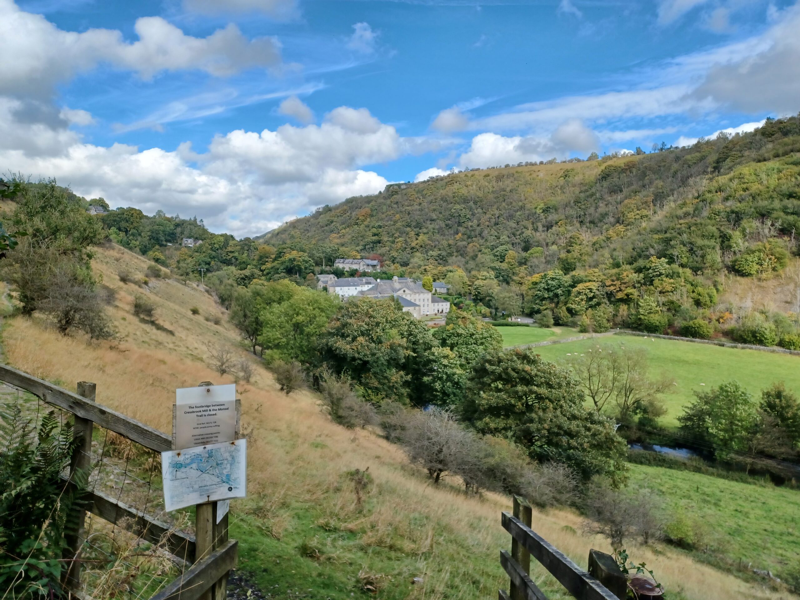
Turning around and retracing my steps to Miller's Dale I stop for an adequate cup of tea and sausage roll in the cafe. Refreshed, I head East to Monsal Head, passing through two more tunnels (Litton - 471m and Cressbrook - 431m). There are spectacular views along the way where the rivers and streams have carved out valleys in the limestone, with the view towards Arkwright's Cressbrook Mill being one of the loveliest.

<figure class="post__image post__image--center"><img loading="lazy" src="https://railwaywalks.timholyoake.uk/media/posts/7/20241004_130059-scaled.jpg" alt="The view towards Cressbrook Mill taken from the Monsal Trail" width="2560" height="1920"  sizes="(max-width: 1920px) 100vw, 1920px" srcset="https://railwaywalks.timholyoake.uk/media/posts/7/responsive/20241004_130059-scaled-xs.jpg 640w ,https://railwaywalks.timholyoake.uk/media/posts/7/responsive/20241004_130059-scaled-sm.jpg 768w ,https://railwaywalks.timholyoake.uk/media/posts/7/responsive/20241004_130059-scaled-md.jpg 1024w ,https://railwaywalks.timholyoake.uk/media/posts/7/responsive/20241004_130059-scaled-lg.jpg 1366w ,https://railwaywalks.timholyoake.uk/media/posts/7/responsive/20241004_130059-scaled-xl.jpg 1600w ,https://railwaywalks.timholyoake.uk/media/posts/7/responsive/20241004_130059-scaled-2xl.jpg 1920w"><figcaption>Cressbrook Mill</figcaption></figure>

I made it to the viaduct at Monsal Head, admired the view again and headed back to Miller's Dale. Walk 6 complete - 15.16km, 19,523 steps, 3hours, 12 minutes, 17 seconds.

<figure class="post__image post__image--center"><a href="https://railwaywalks.timholyoake.uk/wp-content/uploads/2024/10/20241004_131700-scaled.jpg"><img loading="lazy" src="https://railwaywalks.timholyoake.uk/media/posts/7/20241004_131700-scaled-e1728120815243.jpg" alt="Me spoiling the view at the Headstone Viaduct" width="2141" height="1659"  sizes="(max-width: 1920px) 100vw, 1920px" srcset="https://railwaywalks.timholyoake.uk/media/posts/7/responsive/20241004_131700-scaled-e1728120815243-xs.jpg 640w ,https://railwaywalks.timholyoake.uk/media/posts/7/responsive/20241004_131700-scaled-e1728120815243-sm.jpg 768w ,https://railwaywalks.timholyoake.uk/media/posts/7/responsive/20241004_131700-scaled-e1728120815243-md.jpg 1024w ,https://railwaywalks.timholyoake.uk/media/posts/7/responsive/20241004_131700-scaled-e1728120815243-lg.jpg 1366w ,https://railwaywalks.timholyoake.uk/media/posts/7/responsive/20241004_131700-scaled-e1728120815243-xl.jpg 1600w ,https://railwaywalks.timholyoake.uk/media/posts/7/responsive/20241004_131700-scaled-e1728120815243-2xl.jpg 1920w"></a><figcaption>Me spoiling the view at the Headstone Viaduct</figcaption></figure>
            ]]>
        </content>
    </entry>
    <entry>
        <title>Walk 5 - Coombs Road Viaduct, Bakewell to Monsal Head</title>
        <author>
            <name>tim</name>
        </author>
        <link href="https://railwaywalks.timholyoake.uk/walk5/"/>
        <id>https://railwaywalks.timholyoake.uk/walk5/</id>
        <media:content url="https://railwaywalks.timholyoake.uk/media/posts/6/20240912_123811-scaled.jpg" medium="image" />

        <updated>2024-09-12T18:57:57+01:00</updated>
            <summary type="html">
                <![CDATA[
                        <img src="https://railwaywalks.timholyoake.uk/media/posts/6/20240912_123811-scaled.jpg" alt="A three arch stone viaduct across a road" />
                    Fog is the sweat of the never-never navvies who Pound, pound, pound, pound, pound Spikes in the rails to their very own heaven. Towers of London - Andy Partridge (XTC). Six years ago today I had a successful stem cell transplant for Mantle Cell Lymphoma.
                ]]>
            </summary>
        <content type="html">
            <![CDATA[
                    <p><img src="https://railwaywalks.timholyoake.uk/media/posts/6/20240912_123811-scaled.jpg" class="type:primaryImage" alt="A three arch stone viaduct across a road" /></p>
                <blockquote>Fog is the sweat of the never-never <span class="ReferentFragmentdesktop__Highlight-sc-110r0d9-1 jAzSMw">navvies</span> who
<span class="ReferentFragmentdesktop__Highlight-sc-110r0d9-1 jAzSMw">Pound, pound, pound, pound, pound</span>
Spikes in the rails to their very own heaven.

Towers of London - Andy Partridge (XTC).</blockquote>
Six years ago today I had a successful stem cell transplant for <a href="http://mcl.timholyoake.uk">Mantle Cell Lymphoma</a>. I know it was successful as I'm still alive to tell the tale! To celebrate I've walked the half of the Monsal Trail between Bakewell and Monsal Head. The route (especially between Bakewell Station and Monsal Head) was rather busy for what I thought was going to be a quiet September morning - far busier than the Manifold Track earlier on this week.

<figure class="post__image post__image--center"><img loading="lazy" src="https://railwaywalks.timholyoake.uk/media/posts/6/2024-09-12-184943_1920x1080_scrot.png" alt="Today's route (in purple) on a 1923 OS map. Reproduced with the permission of the National Library of Scotland. It goes from Bakewell in the South to Monsal Head in the North-West." width="923" height="716"  sizes="(max-width: 1920px) 100vw, 1920px" srcset="https://railwaywalks.timholyoake.uk/media/posts/6/responsive/2024-09-12-184943_1920x1080_scrot-xs.png 640w ,https://railwaywalks.timholyoake.uk/media/posts/6/responsive/2024-09-12-184943_1920x1080_scrot-sm.png 768w ,https://railwaywalks.timholyoake.uk/media/posts/6/responsive/2024-09-12-184943_1920x1080_scrot-md.png 1024w ,https://railwaywalks.timholyoake.uk/media/posts/6/responsive/2024-09-12-184943_1920x1080_scrot-lg.png 1366w ,https://railwaywalks.timholyoake.uk/media/posts/6/responsive/2024-09-12-184943_1920x1080_scrot-xl.png 1600w ,https://railwaywalks.timholyoake.uk/media/posts/6/responsive/2024-09-12-184943_1920x1080_scrot-2xl.png 1920w"><figcaption>Today's route on a 1923 OS map. Reproduced with the permission of the National Library of Scotland.</figcaption></figure>

However the 1km stretch between Bakewell Station and the Coombs Road Viaduct was almost deserted. My observations on these first five walks have led me to develop a theory, which shall henceforth be known as Holyoake's Railway Walks Theory. It states:
<blockquote>The percentage of people you encounter on a walk along a railway trail (P) who will exchange a greeting is inversely proportional to the number of people you meet on the trail in the preceding 30 minutes (T). P = f/T, where f is a non-negative constant quantifying the normal friendliness of the population walking the route at about the same time as you are.</blockquote>
Conscious that it would be good to eat something after I'd finished walking, I started near the middle of the route at Hassop Station, where there's a very busy cycle hire point, gift shop and cafe. It was a little after 10am when I arrived (four hours parking is £4.50, all day is £5.50) and the number of would-be cyclists waiting to rent their wheels was staggeringly large. I walked smugly past the queue and started out on the trail towards Monsal Head. Walking in this direction 'T' was rather large, so few people wanted to say hello.

<figure class="post__image post__image--center"><img loading="lazy" src="https://railwaywalks.timholyoake.uk/media/posts/6/20240912_102008-scaled.jpg" alt="Outside Hassop Station, stood on the Monsal Trail, a public bridleway, cycle route and footpath. There's a large stone railway bridge in front of me on which a road crosses the route of the path." width="2560" height="1920"  sizes="(max-width: 1920px) 100vw, 1920px" srcset="https://railwaywalks.timholyoake.uk/media/posts/6/responsive/20240912_102008-scaled-xs.jpg 640w ,https://railwaywalks.timholyoake.uk/media/posts/6/responsive/20240912_102008-scaled-sm.jpg 768w ,https://railwaywalks.timholyoake.uk/media/posts/6/responsive/20240912_102008-scaled-md.jpg 1024w ,https://railwaywalks.timholyoake.uk/media/posts/6/responsive/20240912_102008-scaled-lg.jpg 1366w ,https://railwaywalks.timholyoake.uk/media/posts/6/responsive/20240912_102008-scaled-xl.jpg 1600w ,https://railwaywalks.timholyoake.uk/media/posts/6/responsive/20240912_102008-scaled-2xl.jpg 1920w"><figcaption>Outside Hassop Station</figcaption></figure>

The bridges crossing the trail all look very similar. A stone facade, with brickwork laid at an angle of around 45 degrees to the vertical walls forming the interior of the arch.

A few hundred metres past the controversial <a href="https://www.derbyshiretimes.co.uk/business/thornbridge-hall-planning-battle-winners-and-losers-react-to-peak-district-inquiry-result-4079066">Thornbridge Hall</a> developments are the remains of Great Longstone Station. It's a similar size to Breadsall Station on the <a href="https://railwaywalks.timholyoake.uk/walk1/">Great Northern Greenway</a>, but in rather better condition.

<figure class="post__image post__image--center"><img loading="lazy" src="https://railwaywalks.timholyoake.uk/media/posts/6/20240912_104710-scaled.jpg" alt="Great Longstone Station. The view is back along the trail facing towards Bakewell. Two stone platforms flank the path on each side, stretching for perhaps 70 metres towards a bridge over the path. The old station building is in the background on the right hand side of the path. It's fenced off as it's a private house now." width="2560" height="1920"  sizes="(max-width: 1920px) 100vw, 1920px" srcset="https://railwaywalks.timholyoake.uk/media/posts/6/responsive/20240912_104710-scaled-xs.jpg 640w ,https://railwaywalks.timholyoake.uk/media/posts/6/responsive/20240912_104710-scaled-sm.jpg 768w ,https://railwaywalks.timholyoake.uk/media/posts/6/responsive/20240912_104710-scaled-md.jpg 1024w ,https://railwaywalks.timholyoake.uk/media/posts/6/responsive/20240912_104710-scaled-lg.jpg 1366w ,https://railwaywalks.timholyoake.uk/media/posts/6/responsive/20240912_104710-scaled-xl.jpg 1600w ,https://railwaywalks.timholyoake.uk/media/posts/6/responsive/20240912_104710-scaled-2xl.jpg 1920w"><figcaption>Great Longstone Station</figcaption></figure>

The Headstone Tunnel quickly appears. The foliage above the entrance with the steel cage to prevent loose rocks from hitting you makes it feel like you're walking into a dinosaur movie.

<figure class="post__image post__image--center"><img loading="lazy" src="https://railwaywalks.timholyoake.uk/media/posts/6/20240912_105810-scaled.jpg" alt="The approach to the Headstone Tunnel. The steep rock walls on either side and above the portal give the impression of a lush tropical landscape. It's anything but - it's barely 12 centigrade this morning." width="2560" height="1920"  sizes="(max-width: 1920px) 100vw, 1920px" srcset="https://railwaywalks.timholyoake.uk/media/posts/6/responsive/20240912_105810-scaled-xs.jpg 640w ,https://railwaywalks.timholyoake.uk/media/posts/6/responsive/20240912_105810-scaled-sm.jpg 768w ,https://railwaywalks.timholyoake.uk/media/posts/6/responsive/20240912_105810-scaled-md.jpg 1024w ,https://railwaywalks.timholyoake.uk/media/posts/6/responsive/20240912_105810-scaled-lg.jpg 1366w ,https://railwaywalks.timholyoake.uk/media/posts/6/responsive/20240912_105810-scaled-xl.jpg 1600w ,https://railwaywalks.timholyoake.uk/media/posts/6/responsive/20240912_105810-scaled-2xl.jpg 1920w"><figcaption>Headstone Tunnel</figcaption></figure>

The tunnel is mostly dry but dimly lit. You can't see the other end at first as it curves gently to the right. On the other side is the massive Headstone Viaduct below Monsal Head and that's as far in this direction along the trail that I'm going today. I've got an earworm at this point - Towers of London, by XTC, as I'm thinking about the people who built all this, and how difficult and deadly the work must have been in the 1860's.

<figure class="post__image post__image--center"><img loading="lazy" src="https://railwaywalks.timholyoake.uk/media/posts/6/20240912_110557-scaled.jpg" alt="The view from the top of the Headstone Viaduct. You can see the river it crosses in the valley beneath it. The skies look angry." width="2560" height="1920"  sizes="(max-width: 1920px) 100vw, 1920px" srcset="https://railwaywalks.timholyoake.uk/media/posts/6/responsive/20240912_110557-scaled-xs.jpg 640w ,https://railwaywalks.timholyoake.uk/media/posts/6/responsive/20240912_110557-scaled-sm.jpg 768w ,https://railwaywalks.timholyoake.uk/media/posts/6/responsive/20240912_110557-scaled-md.jpg 1024w ,https://railwaywalks.timholyoake.uk/media/posts/6/responsive/20240912_110557-scaled-lg.jpg 1366w ,https://railwaywalks.timholyoake.uk/media/posts/6/responsive/20240912_110557-scaled-xl.jpg 1600w ,https://railwaywalks.timholyoake.uk/media/posts/6/responsive/20240912_110557-scaled-2xl.jpg 1920w"><figcaption>The view from the top of the Headstone Viaduct - it gives little idea about quite what an astonishing piece of engineering it is.</figcaption></figure>

At this point I retrace my steps back to Hassop Station (it's getting really busy now and 'T' is huge) and on to Bakewell Station. The station buildings look as if they're vacant and unloved, despite the thriving industrial units on the approach. As some point the track bed has been filled in to the height of the remaining station platform. The trail dips down a couple of feet after the bridge and normal service is resumed.

<figure class="post__image post__image--center"><img loading="lazy" src="https://railwaywalks.timholyoake.uk/media/posts/6/20240912_125722-scaled.jpg" alt="Looking back along the trail towards Bakewell Station, on the left hand side of the bridge in the middle distance. The remains of the platform edge can be seen stretching back through the bridge to the station buildings. The top of the platform is now level with the trail." width="2560" height="1920"  sizes="(max-width: 1920px) 100vw, 1920px" srcset="https://railwaywalks.timholyoake.uk/media/posts/6/responsive/20240912_125722-scaled-xs.jpg 640w ,https://railwaywalks.timholyoake.uk/media/posts/6/responsive/20240912_125722-scaled-sm.jpg 768w ,https://railwaywalks.timholyoake.uk/media/posts/6/responsive/20240912_125722-scaled-md.jpg 1024w ,https://railwaywalks.timholyoake.uk/media/posts/6/responsive/20240912_125722-scaled-lg.jpg 1366w ,https://railwaywalks.timholyoake.uk/media/posts/6/responsive/20240912_125722-scaled-xl.jpg 1600w ,https://railwaywalks.timholyoake.uk/media/posts/6/responsive/20240912_125722-scaled-2xl.jpg 1920w"><figcaption>The bridge outside Bakewell Station</figcaption></figure>

From here to the Coombs Road Viaduct, 'T' becomes very small indeed. Everyone wants to exchange a greeting! My theory is proven, a Nobel Prize surely awaits.

<figure class="post__image post__image--center"><img loading="lazy" src="https://railwaywalks.timholyoake.uk/media/posts/6/20240912_123551-scaled.jpg" alt="A board announcing the end of the Monsal Trail. If you forced your way through the nettles and brambles you would end up on top of the Coombs Road Viaduct." width="2560" height="1920"  sizes="(max-width: 1920px) 100vw, 1920px" srcset="https://railwaywalks.timholyoake.uk/media/posts/6/responsive/20240912_123551-scaled-xs.jpg 640w ,https://railwaywalks.timholyoake.uk/media/posts/6/responsive/20240912_123551-scaled-sm.jpg 768w ,https://railwaywalks.timholyoake.uk/media/posts/6/responsive/20240912_123551-scaled-md.jpg 1024w ,https://railwaywalks.timholyoake.uk/media/posts/6/responsive/20240912_123551-scaled-lg.jpg 1366w ,https://railwaywalks.timholyoake.uk/media/posts/6/responsive/20240912_123551-scaled-xl.jpg 1600w ,https://railwaywalks.timholyoake.uk/media/posts/6/responsive/20240912_123551-scaled-2xl.jpg 1920w"><figcaption>The end of the trail board - if you forced your way through the nettles, you would be on top of the viaduct.</figcaption></figure>

I've made it to the end, so I nip down to the road to look at the viaduct. It's nothing like as large as the one at Monsal Head, but it's impressive nonetheless. Time to head back to Hassop for lunch.

<figure class="post__image post__image--center"><img loading="lazy" src="https://railwaywalks.timholyoake.uk/media/posts/6/20240912_123811-scaled.jpg" alt="A three arch stone viaduct across a road" width="2560" height="1920"  sizes="(max-width: 1920px) 100vw, 1920px" srcset="https://railwaywalks.timholyoake.uk/media/posts/6/responsive/20240912_123811-scaled-xs.jpg 640w ,https://railwaywalks.timholyoake.uk/media/posts/6/responsive/20240912_123811-scaled-sm.jpg 768w ,https://railwaywalks.timholyoake.uk/media/posts/6/responsive/20240912_123811-scaled-md.jpg 1024w ,https://railwaywalks.timholyoake.uk/media/posts/6/responsive/20240912_123811-scaled-lg.jpg 1366w ,https://railwaywalks.timholyoake.uk/media/posts/6/responsive/20240912_123811-scaled-xl.jpg 1600w ,https://railwaywalks.timholyoake.uk/media/posts/6/responsive/20240912_123811-scaled-2xl.jpg 1920w"><figcaption>The Coombs Road Viaduct, Bakewell</figcaption></figure>

That's all until October as I have other commitments for the rest of September. Today's stats are below. If you enjoyed reading this, <a href="https://www.justgiving.com/page/derbyshire-railway-trails-walk">please consider making a donation to Lymphoma Action</a>. Thank you for your support!

<figure class="post__image post__image--center"><img loading="lazy" src="https://railwaywalks.timholyoake.uk/media/posts/6/Screenshot_20240912-150606.png" alt="" width="1762" height="944"  sizes="(max-width: 1920px) 100vw, 1920px" srcset="https://railwaywalks.timholyoake.uk/media/posts/6/responsive/Screenshot_20240912-150606-xs.png 640w ,https://railwaywalks.timholyoake.uk/media/posts/6/responsive/Screenshot_20240912-150606-sm.png 768w ,https://railwaywalks.timholyoake.uk/media/posts/6/responsive/Screenshot_20240912-150606-md.png 1024w ,https://railwaywalks.timholyoake.uk/media/posts/6/responsive/Screenshot_20240912-150606-lg.png 1366w ,https://railwaywalks.timholyoake.uk/media/posts/6/responsive/Screenshot_20240912-150606-xl.png 1600w ,https://railwaywalks.timholyoake.uk/media/posts/6/responsive/Screenshot_20240912-150606-2xl.png 1920w"><figcaption>14.05km, 18,547 steps in 3 hours, 11 minutes, 46 seconds.</figcaption></figure>
            ]]>
        </content>
    </entry>
    <entry>
        <title>Walk 4 - The Manifold Track - Hulme End to Wetton</title>
        <author>
            <name>tim</name>
        </author>
        <link href="https://railwaywalks.timholyoake.uk/walk-4/"/>
        <id>https://railwaywalks.timholyoake.uk/walk-4/</id>
        <media:content url="https://railwaywalks.timholyoake.uk/media/posts/5/20240909_114534-scaled.jpg" medium="image" />

        <updated>2024-09-09T19:17:52+01:00</updated>
            <summary type="html">
                <![CDATA[
                        <img src="https://railwaywalks.timholyoake.uk/media/posts/5/20240909_114534-scaled.jpg" alt="The Northern Portal of Swainsley Tunnel. The stone arch is surrounded by trees and bushes. There are some dim lights on in the tunnel." />
                    We never have a dull moment on our Branch Line. Rev. W. Awdry - Branch Line Engines (The Railway Series, number 16). The Manifold Track is not in Derbyshire. But it nearly is: Hulme End is a few hundred metres the wrong side of the&hellip;
                ]]>
            </summary>
        <content type="html">
            <![CDATA[
                    <p><img src="https://railwaywalks.timholyoake.uk/media/posts/5/20240909_114534-scaled.jpg" class="type:primaryImage" alt="The Northern Portal of Swainsley Tunnel. The stone arch is surrounded by trees and bushes. There are some dim lights on in the tunnel." /></p>
                <blockquote><span class="Formatted">We never have a dull moment on our Branch Line.</span> Rev. W. Awdry - Branch Line Engines (The Railway Series, number 16).</blockquote>
The Manifold Track is not in Derbyshire. But it <em>nearly</em> is: Hulme End is a few hundred metres the wrong side of the border. When the narrow gauge railway ran between 1904 and 1934, Hulme End Station claimed that it was Hulme End for Hartington - 3 miles away, in Derbyshire.

<figure class="post__image post__image--center"><img loading="lazy" src="https://railwaywalks.timholyoake.uk/media/posts/5/20240909_111655-scaled.jpg" alt="A brown and white timber building housed the station at Hulme End. It's now the visitor centre for the Manifold Track." width="2560" height="1920"  sizes="(max-width: 1920px) 100vw, 1920px" srcset="https://railwaywalks.timholyoake.uk/media/posts/5/responsive/20240909_111655-scaled-xs.jpg 640w ,https://railwaywalks.timholyoake.uk/media/posts/5/responsive/20240909_111655-scaled-sm.jpg 768w ,https://railwaywalks.timholyoake.uk/media/posts/5/responsive/20240909_111655-scaled-md.jpg 1024w ,https://railwaywalks.timholyoake.uk/media/posts/5/responsive/20240909_111655-scaled-lg.jpg 1366w ,https://railwaywalks.timholyoake.uk/media/posts/5/responsive/20240909_111655-scaled-xl.jpg 1600w ,https://railwaywalks.timholyoake.uk/media/posts/5/responsive/20240909_111655-scaled-2xl.jpg 1920w"><figcaption>Hulme End Station</figcaption></figure>

As I hadn't walked along this path since 1968 (Hulme End was the site of the very first Caravan Club rally I was taken to, aged 4) I thought I'd stretch the map a little, rather like the railway owners did.

<figure class="post__image post__image--center"><img loading="lazy" src="https://railwaywalks.timholyoake.uk/media/posts/5/2024-09-09-180201_1920x1080_scrot.png" alt="A map showing my route from Hulme End to Wetton, along the Manifold Track." width="679" height="750"  sizes="(max-width: 1920px) 100vw, 1920px" srcset="https://railwaywalks.timholyoake.uk/media/posts/5/responsive/2024-09-09-180201_1920x1080_scrot-xs.png 640w ,https://railwaywalks.timholyoake.uk/media/posts/5/responsive/2024-09-09-180201_1920x1080_scrot-sm.png 768w ,https://railwaywalks.timholyoake.uk/media/posts/5/responsive/2024-09-09-180201_1920x1080_scrot-md.png 1024w ,https://railwaywalks.timholyoake.uk/media/posts/5/responsive/2024-09-09-180201_1920x1080_scrot-lg.png 1366w ,https://railwaywalks.timholyoake.uk/media/posts/5/responsive/2024-09-09-180201_1920x1080_scrot-xl.png 1600w ,https://railwaywalks.timholyoake.uk/media/posts/5/responsive/2024-09-09-180201_1920x1080_scrot-2xl.png 1920w"><figcaption>1924 OS map with my route shown in blue. Reproduced with the permission of the National Library of Scotland.</figcaption></figure>

The main traffic on the line was milk. Ecton Station was the primary loading point for trains heading to Waterhouses, where the milk would be transferred onto the main line. As the dairy at Ecton decided to switch to road transportation in 1930, the line's fate was sealed.

<figure class="post__image post__image--center"><img loading="lazy" src="https://railwaywalks.timholyoake.uk/media/posts/5/20240909_142117-scaled.jpg" alt="The site of Ecton Station. Apart from the gravelled areas and the remains of a platform on the right hand side of the picture, there's little to suggest that this was the busiest station on the railway." width="2560" height="1920"  sizes="(max-width: 1920px) 100vw, 1920px" srcset="https://railwaywalks.timholyoake.uk/media/posts/5/responsive/20240909_142117-scaled-xs.jpg 640w ,https://railwaywalks.timholyoake.uk/media/posts/5/responsive/20240909_142117-scaled-sm.jpg 768w ,https://railwaywalks.timholyoake.uk/media/posts/5/responsive/20240909_142117-scaled-md.jpg 1024w ,https://railwaywalks.timholyoake.uk/media/posts/5/responsive/20240909_142117-scaled-lg.jpg 1366w ,https://railwaywalks.timholyoake.uk/media/posts/5/responsive/20240909_142117-scaled-xl.jpg 1600w ,https://railwaywalks.timholyoake.uk/media/posts/5/responsive/20240909_142117-scaled-2xl.jpg 1920w"><figcaption>Ecton Station</figcaption></figure>

There's <a href="https://www.britishpathe.com/asset/57701/">a short 1933 newsreel</a> of a train heading from Hulme End, through the tunnel at Swainsley and on to the station at Thor's Cave and Wetton, the route I walked today.

<figure class="post__image post__image--center"><img loading="lazy" src="https://railwaywalks.timholyoake.uk/media/posts/5/20240909_114534-scaled.jpg" alt="The Northern Portal of Swainsley Tunnel. The stone arch is surrounded by trees and bushes. There are some dim lights on in the tunnel." width="2560" height="1920"  sizes="(max-width: 1920px) 100vw, 1920px" srcset="https://railwaywalks.timholyoake.uk/media/posts/5/responsive/20240909_114534-scaled-xs.jpg 640w ,https://railwaywalks.timholyoake.uk/media/posts/5/responsive/20240909_114534-scaled-sm.jpg 768w ,https://railwaywalks.timholyoake.uk/media/posts/5/responsive/20240909_114534-scaled-md.jpg 1024w ,https://railwaywalks.timholyoake.uk/media/posts/5/responsive/20240909_114534-scaled-lg.jpg 1366w ,https://railwaywalks.timholyoake.uk/media/posts/5/responsive/20240909_114534-scaled-xl.jpg 1600w ,https://railwaywalks.timholyoake.uk/media/posts/5/responsive/20240909_114534-scaled-2xl.jpg 1920w"><figcaption>Swainsley Tunnel</figcaption></figure>

I also scrambled up the footpath to Wetton, a pretty little place that seems largely unchanged since the 1924 map was published.

<figure class="post__image post__image--center"><img loading="lazy" src="https://railwaywalks.timholyoake.uk/media/posts/5/20240909_132009-scaled.jpg" alt="A picture of moorlands, with a limestone outcrop and cave (Thor's Cave) in the middle distance." width="2560" height="1920"  sizes="(max-width: 1920px) 100vw, 1920px" srcset="https://railwaywalks.timholyoake.uk/media/posts/5/responsive/20240909_132009-scaled-xs.jpg 640w ,https://railwaywalks.timholyoake.uk/media/posts/5/responsive/20240909_132009-scaled-sm.jpg 768w ,https://railwaywalks.timholyoake.uk/media/posts/5/responsive/20240909_132009-scaled-md.jpg 1024w ,https://railwaywalks.timholyoake.uk/media/posts/5/responsive/20240909_132009-scaled-lg.jpg 1366w ,https://railwaywalks.timholyoake.uk/media/posts/5/responsive/20240909_132009-scaled-xl.jpg 1600w ,https://railwaywalks.timholyoake.uk/media/posts/5/responsive/20240909_132009-scaled-2xl.jpg 1920w"><figcaption>Thor's Cave, viewed from Wetton. The track is in the valley below.</figcaption></figure>

There were very few people around today, but most were cheerful. One rider was hilariously scolding her horse for eating everything that grew alongside the track. Another couple I met just after the tunnel at Swainsley thought they'd missed the track, but it follows a quiet road after the tunnel for a mile or so before turning back into a footpath and bridleway after Wetton Mill. There's a cafe there where I bought a mug of tea and cake (£5.15), eaten under the watchful gaze of a hen.

<figure class="post__image post__image--center"><img loading="lazy" src="https://railwaywalks.timholyoake.uk/media/posts/5/20240909_121906-scaled.jpg" alt="A white hen, stood on a picnic bench" width="2560" height="1920"  sizes="(max-width: 1920px) 100vw, 1920px" srcset="https://railwaywalks.timholyoake.uk/media/posts/5/responsive/20240909_121906-scaled-xs.jpg 640w ,https://railwaywalks.timholyoake.uk/media/posts/5/responsive/20240909_121906-scaled-sm.jpg 768w ,https://railwaywalks.timholyoake.uk/media/posts/5/responsive/20240909_121906-scaled-md.jpg 1024w ,https://railwaywalks.timholyoake.uk/media/posts/5/responsive/20240909_121906-scaled-lg.jpg 1366w ,https://railwaywalks.timholyoake.uk/media/posts/5/responsive/20240909_121906-scaled-xl.jpg 1600w ,https://railwaywalks.timholyoake.uk/media/posts/5/responsive/20240909_121906-scaled-2xl.jpg 1920w"><figcaption>The guard hen at Wetton Mill</figcaption></figure>

Today I covered 14.09km in 3hours, 11 minutes and 12 seconds, taking 18,780 steps in the process.

<figure class="post__image post__image--center"><img loading="lazy" src="https://railwaywalks.timholyoake.uk/media/posts/5/Screenshot_20240909-191005.png" alt="A fitbit map, showing my route from Hulme End to Wetton" width="1191" height="1578"  sizes="(max-width: 1920px) 100vw, 1920px" srcset="https://railwaywalks.timholyoake.uk/media/posts/5/responsive/Screenshot_20240909-191005-xs.png 640w ,https://railwaywalks.timholyoake.uk/media/posts/5/responsive/Screenshot_20240909-191005-sm.png 768w ,https://railwaywalks.timholyoake.uk/media/posts/5/responsive/Screenshot_20240909-191005-md.png 1024w ,https://railwaywalks.timholyoake.uk/media/posts/5/responsive/Screenshot_20240909-191005-lg.png 1366w ,https://railwaywalks.timholyoake.uk/media/posts/5/responsive/Screenshot_20240909-191005-xl.png 1600w ,https://railwaywalks.timholyoake.uk/media/posts/5/responsive/Screenshot_20240909-191005-2xl.png 1920w"><figcaption>Today's walk</figcaption></figure>

If you enjoyed reading this, <a href="https://www.justgiving.com/page/derbyshire-railway-trails-walk">please consider making a donation to Lymphoma Action</a>. Thank you for your support!
            ]]>
        </content>
    </entry>
    <entry>
        <title>Walk 3 - High Peak Junction to Middleton Top</title>
        <author>
            <name>tim</name>
        </author>
        <link href="https://railwaywalks.timholyoake.uk/walk3/"/>
        <id>https://railwaywalks.timholyoake.uk/walk3/</id>
        <media:content url="https://railwaywalks.timholyoake.uk/media/posts/4/20240906_150033-scaled-1ff0b6fa.jpg" medium="image" />

        <updated>2024-09-07T10:41:35+01:00</updated>
            <summary type="html">
                <![CDATA[
                        <img src="https://railwaywalks.timholyoake.uk/media/posts/4/20240906_150033-scaled-1ff0b6fa.jpg" alt="" />
                    &nbsp; &nbsp; Sam the Eagle (to a young Scrooge): Oh, you will love business. It is the American Way. Gonzo (whispering): Uh, Sam ... Sam the Eagle: Oh. It is the BRITISH WAY. The Muppet Christmas Carol. The route of the High Peak Trail -&hellip;
                ]]>
            </summary>
        <content type="html">
            <![CDATA[
                    <p><img src="https://railwaywalks.timholyoake.uk/media/posts/4/20240906_150033-scaled-1ff0b6fa.jpg" class="type:primaryImage" alt="" /></p>
                <blockquote>&nbsp;

&nbsp;
<p class="align-left">Sam the Eagle (to a young Scrooge): Oh, you will love business. It is the American Way.</p>
<p class="align-left">Gonzo (whispering): Uh, Sam ...</p>
<p class="align-left">Sam the Eagle: Oh. It is the BRITISH WAY.</p>
<p class="align-left">The Muppet Christmas Carol.</p>
</blockquote>
<figure class="post__image post__image--center"><img loading="lazy" src="https://railwaywalks.timholyoake.uk/media/posts/4/2024-09-06-095119_1920x1080_scrot.png" alt="The route of the High Peak Trail (Cromford and High Peak Line) - High Peak Junction to Middleton Top" width="1788" height="487"  sizes="(max-width: 1920px) 100vw, 1920px" srcset="https://railwaywalks.timholyoake.uk/media/posts/4/responsive/2024-09-06-095119_1920x1080_scrot-xs.png 640w ,https://railwaywalks.timholyoake.uk/media/posts/4/responsive/2024-09-06-095119_1920x1080_scrot-sm.png 768w ,https://railwaywalks.timholyoake.uk/media/posts/4/responsive/2024-09-06-095119_1920x1080_scrot-md.png 1024w ,https://railwaywalks.timholyoake.uk/media/posts/4/responsive/2024-09-06-095119_1920x1080_scrot-lg.png 1366w ,https://railwaywalks.timholyoake.uk/media/posts/4/responsive/2024-09-06-095119_1920x1080_scrot-xl.png 1600w ,https://railwaywalks.timholyoake.uk/media/posts/4/responsive/2024-09-06-095119_1920x1080_scrot-2xl.png 1920w"><figcaption>The route of the High Peak Trail - High Peak Junction to Middleton Top. 1924 OS Map. Reproduced with the permission of the National Library of Scotland.</figcaption></figure>

The railway was opened in 1831 to link the Cromford Canal at High Peak Junction (my start point for yesterday's walk) with the Peak Forest Canal at Whaley Bridge, 33 miles away. The modern trail ends to the North of Hurdlow, 17 miles from High Peak Junction.

I walked as far as Middleton Top - a six mile round trip, including a 15 minute diversion each way along the Cromford Canal to get to and from the car park at High Peak Junction. The footbridge was meant to have re-opened on 24th August, but Severn Trent's works are over-running. There was no activity taking place yesterday, so I guess the footbridge will be closed for some time to come. Maybe the County Council should personally fine the CEO £1,000 per day for over-running works - I bet that would have an instantaneous effect on punctuality.

Rant over, and you're probably thinking that a 6 mile round-trip doesn't sound very far. However, the Cromford and High Peak Railway was designed to carry goods and minerals, the driving force of 19th and early 20th century business. As such, the normal rules of railway construction (nice, flat routes preferred) didn't apply. The steep inclines (1 in 8 gradients) between these two points were conquered by the use of huge beam engines to haul the wagons. On this section of the route there were three. The remains of the engine house for the first are barely visible, the second (at Sheep Top Pasture) is a well-preserved shell, but the third at Middleton Top is gloriously complete. It's open on a number of Sundays and Bank Holidays throughout the year and is well worth a visit to gawp at the wonders of Victorian engineering.

The three engines raised wagons a combined 718 feet (220 metres) in a little over two and a half miles, with the first 465 feet (143 metres) being achieved in the first 1,320 yards (1.2km). Unsurprisingly, I can feel all of this height gain in my calves today.

Enough of the mind-boggling stats - here are some pictures from my walk.

<div class="gallery-wrapper"><div class="gallery" data-is-empty="false" data-translation="Add images" data-columns="1"><figure class="gallery__item"><a href="https://railwaywalks.timholyoake.uk/media/posts/4/gallery/20240906_162654-scaled.jpg" data-size="2560x1920"><img src="https://railwaywalks.timholyoake.uk/media/posts/4/gallery/20240906_162654-scaled-thumbnail.jpg" alt="" width="720" height="540"></a><figcaption>The Leawood pumping house at the side of the Cromford Canal</figcaption></figure><figure class="gallery__item"><a href="https://railwaywalks.timholyoake.uk/media/posts/4/gallery/20240906_140035-scaled.jpg" data-size="2560x1920"><img loading="lazy" src="https://railwaywalks.timholyoake.uk/media/posts/4/gallery/20240906_140035-scaled-thumbnail.jpg" alt="" width="720" height="540"></a><figcaption>High Peak Junction</figcaption></figure><figure class="gallery__item"><a href="https://railwaywalks.timholyoake.uk/media/posts/4/gallery/20240906_161535-scaled.jpg" data-size="2560x1920"><img src="https://railwaywalks.timholyoake.uk/media/posts/4/gallery/20240906_161535-scaled-thumbnail.jpg" alt="" width="720" height="540"></a><figcaption>The catch pit near High Peak Junction - if wagons broke loose they'd be travelling at 120mph if they went in here</figcaption></figure><figure class="gallery__item"><a href="https://railwaywalks.timholyoake.uk/media/posts/4/gallery/20240906_141037-scaled.jpg" data-size="2560x1920"><img loading="lazy" src="https://railwaywalks.timholyoake.uk/media/posts/4/gallery/20240906_141037-scaled-thumbnail.jpg" alt="" width="720" height="540"></a><figcaption>The site of the first engine house - halfway up the 1,320 yards of the incline</figcaption></figure><figure class="gallery__item"><a href="https://railwaywalks.timholyoake.uk/media/posts/4/gallery/20240906_142154-scaled.jpg" data-size="2560x1920"><img src="https://railwaywalks.timholyoake.uk/media/posts/4/gallery/20240906_142154-scaled-thumbnail.jpg" alt="" width="720" height="540"></a><figcaption>The remains of the Sheep Top engine house</figcaption></figure><figure class="gallery__item"><a href="https://railwaywalks.timholyoake.uk/media/posts/4/gallery/20240906_160113-scaled.jpg" data-size="2560x1920"><img loading="lazy" src="https://railwaywalks.timholyoake.uk/media/posts/4/gallery/20240906_160113-scaled-thumbnail.jpg" alt="" width="720" height="540"></a><figcaption>Looking down the first incline - the picture doesn't give a true impression of how steep, or how long it is!</figcaption></figure><figure class="gallery__item"><a href="https://railwaywalks.timholyoake.uk/media/posts/4/gallery/20240906_142313-scaled.jpg" data-size="2560x1920"><img src="https://railwaywalks.timholyoake.uk/media/posts/4/gallery/20240906_142313-scaled-thumbnail.jpg" alt="" width="720" height="540"></a><figcaption>The view from Sheep Top Pasture towards Cromford and Matlock</figcaption></figure><figure class="gallery__item"><a href="https://railwaywalks.timholyoake.uk/media/posts/4/gallery/20240906_145056-scaled.jpg" data-size="2560x1920"><img loading="lazy" src="https://railwaywalks.timholyoake.uk/media/posts/4/gallery/20240906_145056-scaled-thumbnail.jpg" alt="" width="720" height="540"></a><figcaption>The remains of the wheel pit at the bottom of the Middleton incline</figcaption></figure><figure class="gallery__item"><a href="https://railwaywalks.timholyoake.uk/media/posts/4/gallery/20240906_150033-scaled.jpg" data-size="2560x1920"><img src="https://railwaywalks.timholyoake.uk/media/posts/4/gallery/20240906_150033-scaled-thumbnail.jpg" alt="" width="720" height="540"></a><figcaption>650 metres later and the Middleton Top engine house appears</figcaption></figure><figure class="gallery__item"><a href="https://railwaywalks.timholyoake.uk/media/posts/4/gallery/20240906_150533-scaled.jpg" data-size="2560x1920"><img loading="lazy" src="https://railwaywalks.timholyoake.uk/media/posts/4/gallery/20240906_150533-scaled-thumbnail.jpg" alt="" width="720" height="540"></a><figcaption>A well-deserved ice-cream before heading back down</figcaption></figure></div></div>

Back to the stats. The walk took 2 hours, 42 minutes and 29 seconds. I covered 11.42km and took 15,594 steps. You might be able to spot where the inclines are from the record of my heart rate during the walk up ...

<figure class="post__image post__image--center"><img loading="lazy" src="https://railwaywalks.timholyoake.uk/media/posts/4/Screenshot_20240907_103226-e1725701772570.jpg" alt="" width="720" height="765"  sizes="(max-width: 1920px) 100vw, 1920px" srcset="https://railwaywalks.timholyoake.uk/media/posts/4/responsive/Screenshot_20240907_103226-e1725701772570-xs.jpg 640w ,https://railwaywalks.timholyoake.uk/media/posts/4/responsive/Screenshot_20240907_103226-e1725701772570-sm.jpg 768w ,https://railwaywalks.timholyoake.uk/media/posts/4/responsive/Screenshot_20240907_103226-e1725701772570-md.jpg 1024w ,https://railwaywalks.timholyoake.uk/media/posts/4/responsive/Screenshot_20240907_103226-e1725701772570-lg.jpg 1366w ,https://railwaywalks.timholyoake.uk/media/posts/4/responsive/Screenshot_20240907_103226-e1725701772570-xl.jpg 1600w ,https://railwaywalks.timholyoake.uk/media/posts/4/responsive/Screenshot_20240907_103226-e1725701772570-2xl.jpg 1920w"><figcaption>Spot the inclines!</figcaption></figure>

If you enjoyed reading this, <a href="https://www.justgiving.com/page/derbyshire-railway-trails-walk">please consider making a donation to Lymphoma Action</a>. Thank you for your support!
            ]]>
        </content>
    </entry>
    <entry>
        <title>Walk 2 - The Bennerley Viaduct</title>
        <author>
            <name>tim</name>
        </author>
        <link href="https://railwaywalks.timholyoake.uk/walk2/"/>
        <id>https://railwaywalks.timholyoake.uk/walk2/</id>
        <media:content url="https://railwaywalks.timholyoake.uk/media/posts/3/20240904_103756-scaled.jpg" medium="image" />

        <updated>2024-09-04T14:47:21+01:00</updated>
            <summary type="html">
                <![CDATA[
                        <img src="https://railwaywalks.timholyoake.uk/media/posts/3/20240904_103756-scaled.jpg" alt="A view from underneath Bennerley Viaduct, showing the latice-work iron girders that form each of the columns holding up the deck, which is also made of iron." />
                    The Iron Man came to the top of the cliff. How far had he walked? Nobody knows. Where had he come from? Nobody knows. How was he made? Nobody knows. Taller than a house, the Iron Man stood at the top of the cliff, on&hellip;
                ]]>
            </summary>
        <content type="html">
            <![CDATA[
                    <p><img src="https://railwaywalks.timholyoake.uk/media/posts/3/20240904_103756-scaled.jpg" class="type:primaryImage" alt="A view from underneath Bennerley Viaduct, showing the latice-work iron girders that form each of the columns holding up the deck, which is also made of iron." /></p>
                <blockquote>The Iron Man came to the top of the cliff. How far had he walked? Nobody knows. Where had he come from? Nobody knows. How was he made? Nobody knows. Taller than a house, the Iron Man stood at the top of the cliff, on the very brink, in the darkness. <em>Ted Hughes - The Iron Man.</em></blockquote>
Continuing on the Great Northern Railway theme, this morning's walk took me on a circular route around the Bennerley Viaduct - The Iron Giant. Starting from (the new) Ilkeston Station, the first part of my route took me alongside the Erewash Canal.

<figure class="post__image post__image--center"><img loading="lazy" src="https://railwaywalks.timholyoake.uk/media/posts/3/20240904_100808-scaled.jpg" alt="A narrow boat in a canal lock, being slowly raised up by water filtering in through the lock gates just out of sight on the right hand side." width="2560" height="1920"  sizes="(max-width: 1920px) 100vw, 1920px" srcset="https://railwaywalks.timholyoake.uk/media/posts/3/responsive/20240904_100808-scaled-xs.jpg 640w ,https://railwaywalks.timholyoake.uk/media/posts/3/responsive/20240904_100808-scaled-sm.jpg 768w ,https://railwaywalks.timholyoake.uk/media/posts/3/responsive/20240904_100808-scaled-md.jpg 1024w ,https://railwaywalks.timholyoake.uk/media/posts/3/responsive/20240904_100808-scaled-lg.jpg 1366w ,https://railwaywalks.timholyoake.uk/media/posts/3/responsive/20240904_100808-scaled-xl.jpg 1600w ,https://railwaywalks.timholyoake.uk/media/posts/3/responsive/20240904_100808-scaled-2xl.jpg 1920w"><figcaption>Stenson's Lock (number 71) on the Erewash Canal</figcaption></figure>

The viaduct isn't visible from the canal towpath until you've almost arrived. This was my first glimpse of it.

<figure class="post__image post__image--center"><img loading="lazy" src="https://railwaywalks.timholyoake.uk/media/posts/3/20240904_101112-scaled.jpg" alt="Surrounded by trees and bushes on each side of the frame, this is a view of the Bennerley Viaduct from the Erewash Canal towpath" width="2560" height="1920"  sizes="(max-width: 1920px) 100vw, 1920px" srcset="https://railwaywalks.timholyoake.uk/media/posts/3/responsive/20240904_101112-scaled-xs.jpg 640w ,https://railwaywalks.timholyoake.uk/media/posts/3/responsive/20240904_101112-scaled-sm.jpg 768w ,https://railwaywalks.timholyoake.uk/media/posts/3/responsive/20240904_101112-scaled-md.jpg 1024w ,https://railwaywalks.timholyoake.uk/media/posts/3/responsive/20240904_101112-scaled-lg.jpg 1366w ,https://railwaywalks.timholyoake.uk/media/posts/3/responsive/20240904_101112-scaled-xl.jpg 1600w ,https://railwaywalks.timholyoake.uk/media/posts/3/responsive/20240904_101112-scaled-2xl.jpg 1920w"><figcaption>I see you!</figcaption></figure>

I walked up the ramp from the canal to the deck. Amazingly, I was the only person on the viaduct at around 10am this morning. It creaks a little when you walk on it and there are some alarmingly large rusty holes between the edge of the deck and the railings, but I imagine that it's safe enough. It has been there since 1877, after all.

<figure class="post__image post__image--center"><img loading="lazy" src="https://railwaywalks.timholyoake.uk/media/posts/3/20240904_101251-scaled.jpg" alt="A view of the deck of the Bennerley Viaduct, looking towards Awsworth in Nottinghamshire" width="2560" height="1920"  sizes="(max-width: 1920px) 100vw, 1920px" srcset="https://railwaywalks.timholyoake.uk/media/posts/3/responsive/20240904_101251-scaled-xs.jpg 640w ,https://railwaywalks.timholyoake.uk/media/posts/3/responsive/20240904_101251-scaled-sm.jpg 768w ,https://railwaywalks.timholyoake.uk/media/posts/3/responsive/20240904_101251-scaled-md.jpg 1024w ,https://railwaywalks.timholyoake.uk/media/posts/3/responsive/20240904_101251-scaled-lg.jpg 1366w ,https://railwaywalks.timholyoake.uk/media/posts/3/responsive/20240904_101251-scaled-xl.jpg 1600w ,https://railwaywalks.timholyoake.uk/media/posts/3/responsive/20240904_101251-scaled-2xl.jpg 1920w"><figcaption>Looking towards Awsworth, Nottinghamshire, across the deck of the viaduct</figcaption></figure>

The Nottinghamshire end is currently fenced off, as the <a href="https://www.bennerleyviaduct.org.uk/">Friends of Bennerley Viaduct charity</a> is working to improve access for visitors. A ramp up to the viaduct is being constructed (when I visited after it opened to the public a couple of years ago, the only way up to the viaduct from that side was by a set of rather steep steps). The work is running behind schedule (it was originally meant to be finished in June, then August) but the closure really doesn't spoil the enjoyment of this behemoth. There is also evidence of a car park and visitor centre being constructed.

Retracing my steps, I head along a footpath just off the canal towpath to view the viaduct from underneath. It's an astounding sight.

<figure class="post__image post__image--center"><img loading="lazy" src="https://railwaywalks.timholyoake.uk/media/posts/3/20240904_103756-scaled.jpg" alt="A view from underneath Bennerley Viaduct, showing the latice-work iron girders that form each of the columns holding up the deck, which is also made of iron." width="2560" height="1920"  sizes="(max-width: 1920px) 100vw, 1920px" srcset="https://railwaywalks.timholyoake.uk/media/posts/3/responsive/20240904_103756-scaled-xs.jpg 640w ,https://railwaywalks.timholyoake.uk/media/posts/3/responsive/20240904_103756-scaled-sm.jpg 768w ,https://railwaywalks.timholyoake.uk/media/posts/3/responsive/20240904_103756-scaled-md.jpg 1024w ,https://railwaywalks.timholyoake.uk/media/posts/3/responsive/20240904_103756-scaled-lg.jpg 1366w ,https://railwaywalks.timholyoake.uk/media/posts/3/responsive/20240904_103756-scaled-xl.jpg 1600w ,https://railwaywalks.timholyoake.uk/media/posts/3/responsive/20240904_103756-scaled-2xl.jpg 1920w"><figcaption>Underneath the viaduct</figcaption></figure>

At the moment it's not possible to do very much walking under the Iron Giant, due to a combination of the closure of the access from the Awsworth end and the closure of the unsafe bridge into the former Bennerley Sidings to the North of the viaduct. So I head back to the canal towpath and follow it to the Erewash Valley bridleway, hoping to see a wider perspective. The map seems to suggest that it should be possible, but it's well hidden behind trees and bushes again. I spot a gap in the fence off the bridleway and into the sidings, scramble up a bank, and at last I get an end to end view.

<figure class="post__image post__image--center"><img loading="lazy" src="https://railwaywalks.timholyoake.uk/media/posts/3/20240904_105756-scaled.jpg" alt="An end to end view of Bennerley Viaduct from the derelict industrial land to the North." width="2560" height="1920"  sizes="(max-width: 1920px) 100vw, 1920px" srcset="https://railwaywalks.timholyoake.uk/media/posts/3/responsive/20240904_105756-scaled-xs.jpg 640w ,https://railwaywalks.timholyoake.uk/media/posts/3/responsive/20240904_105756-scaled-sm.jpg 768w ,https://railwaywalks.timholyoake.uk/media/posts/3/responsive/20240904_105756-scaled-md.jpg 1024w ,https://railwaywalks.timholyoake.uk/media/posts/3/responsive/20240904_105756-scaled-lg.jpg 1366w ,https://railwaywalks.timholyoake.uk/media/posts/3/responsive/20240904_105756-scaled-xl.jpg 1600w ,https://railwaywalks.timholyoake.uk/media/posts/3/responsive/20240904_105756-scaled-2xl.jpg 1920w"><figcaption>A view of the viaduct from the Northern side. The derelict sidings and works have no remaining buildings, but there are hundreds of metres of concrete roads, slowly being reclaimed by nature.</figcaption></figure>

For something so large, far taller than a house, it vanishes with seeming ease into the surroundings of the Erewash Valley. I'm sure that at some point this site will be redeveloped, but for the moment the Iron Giant stands alone.

I walk back along the Awsworth branch of the Nottingham Canal which is a busy spot for anglers. One final glance back at the viaduct from the South and before long I'm back at Ilkeston Station.

<figure class="post__image post__image--center"><img loading="lazy" src="https://railwaywalks.timholyoake.uk/media/posts/3/20240904_111225-scaled.jpg" alt="A view over the Erewash Valley, with Bennerley Viaduct in the distance." width="2560" height="1920"  sizes="(max-width: 1920px) 100vw, 1920px" srcset="https://railwaywalks.timholyoake.uk/media/posts/3/responsive/20240904_111225-scaled-xs.jpg 640w ,https://railwaywalks.timholyoake.uk/media/posts/3/responsive/20240904_111225-scaled-sm.jpg 768w ,https://railwaywalks.timholyoake.uk/media/posts/3/responsive/20240904_111225-scaled-md.jpg 1024w ,https://railwaywalks.timholyoake.uk/media/posts/3/responsive/20240904_111225-scaled-lg.jpg 1366w ,https://railwaywalks.timholyoake.uk/media/posts/3/responsive/20240904_111225-scaled-xl.jpg 1600w ,https://railwaywalks.timholyoake.uk/media/posts/3/responsive/20240904_111225-scaled-2xl.jpg 1920w"><figcaption>A view from the South</figcaption></figure>

It really is worth the effort to visit the viaduct, which should become easier when the car park opens at the Awsworth side. In the meantime, don't let a 20-25 minute walk from the long stay car park at Ilkeston Station put you off going. At the time of writing, this is a bargain at £3 for 24 hours, or £1.50 if you arrive after 10am.

To the maps. The first is the area in 1966, with Bennerley Sidings visible to the North of the viaduct.

<figure class="post__image post__image--center"><img loading="lazy" src="https://railwaywalks.timholyoake.uk/media/posts/3/2024-09-04-142636_1920x1080_scrot.png" alt="A 6 inch to the mile map of the area around Bennerley Viaduct, published by the Ordnance Survey in 1966." width="1176" height="839"  sizes="(max-width: 1920px) 100vw, 1920px" srcset="https://railwaywalks.timholyoake.uk/media/posts/3/responsive/2024-09-04-142636_1920x1080_scrot-xs.png 640w ,https://railwaywalks.timholyoake.uk/media/posts/3/responsive/2024-09-04-142636_1920x1080_scrot-sm.png 768w ,https://railwaywalks.timholyoake.uk/media/posts/3/responsive/2024-09-04-142636_1920x1080_scrot-md.png 1024w ,https://railwaywalks.timholyoake.uk/media/posts/3/responsive/2024-09-04-142636_1920x1080_scrot-lg.png 1366w ,https://railwaywalks.timholyoake.uk/media/posts/3/responsive/2024-09-04-142636_1920x1080_scrot-xl.png 1600w ,https://railwaywalks.timholyoake.uk/media/posts/3/responsive/2024-09-04-142636_1920x1080_scrot-2xl.png 1920w"><figcaption>The area around Bennerley Viaduct from a 1966 OS map. Reproduced with the permission of the National Library of Scotland.</figcaption></figure>

The second is of my walk today.

<figure class="post__image post__image--center"><img loading="lazy" src="https://railwaywalks.timholyoake.uk/media/posts/3/Screenshot_20240904-144229.png" alt="A fitbit map of today's walk around Bennerley Viaduct, showing my pace along the route." width="2000" height="1200"  sizes="(max-width: 1920px) 100vw, 1920px" srcset="https://railwaywalks.timholyoake.uk/media/posts/3/responsive/Screenshot_20240904-144229-xs.png 640w ,https://railwaywalks.timholyoake.uk/media/posts/3/responsive/Screenshot_20240904-144229-sm.png 768w ,https://railwaywalks.timholyoake.uk/media/posts/3/responsive/Screenshot_20240904-144229-md.png 1024w ,https://railwaywalks.timholyoake.uk/media/posts/3/responsive/Screenshot_20240904-144229-lg.png 1366w ,https://railwaywalks.timholyoake.uk/media/posts/3/responsive/Screenshot_20240904-144229-xl.png 1600w ,https://railwaywalks.timholyoake.uk/media/posts/3/responsive/Screenshot_20240904-144229-2xl.png 1920w"><figcaption>1 hour, 40 minutes, 6 seconds; 6.48km; 9,169 steps.</figcaption></figure>

If you enjoyed reading this, <a href="https://www.justgiving.com/page/derbyshire-railway-trails-walk">please consider making a donation to Lymphoma Action</a>. Thank you for your support!
            ]]>
        </content>
    </entry>
    <entry>
        <title>Walk 1 - The Great Northern Greenway</title>
        <author>
            <name>tim</name>
        </author>
        <link href="https://railwaywalks.timholyoake.uk/walk1/"/>
        <id>https://railwaywalks.timholyoake.uk/walk1/</id>
        <media:content url="https://railwaywalks.timholyoake.uk/media/posts/2/20240901_112142-scaled-02c503ad.jpg" medium="image" />

        <updated>2024-09-01T17:20:32+01:00</updated>
            <summary type="html">
                <![CDATA[
                        <img src="https://railwaywalks.timholyoake.uk/media/posts/2/20240901_112142-scaled-02c503ad.jpg" alt="A sign that reads General Waiting Room on the side of a building overrun with brambles" />
                    'But,' he skewed towards the castle, 'it's worse in there. There, the map says, the boundary is undefined.' Alan Garner, Red Shift. The forecast was for thunderstorms, so it was with some trepidation I set off on my first walk this morning. Fortunately the weather&hellip;
                ]]>
            </summary>
        <content type="html">
            <![CDATA[
                    <p><img src="https://railwaywalks.timholyoake.uk/media/posts/2/20240901_112142-scaled-02c503ad.jpg" class="type:primaryImage" alt="A sign that reads General Waiting Room on the side of a building overrun with brambles" /></p>
                <blockquote>'But,' he skewed towards the castle, 'it's worse in there. There, the map says, the boundary is undefined.'  Alan Garner, Red Shift.</blockquote>
The forecast was for thunderstorms, so it was with some trepidation I set off on my first walk this morning. Fortunately the weather held and I had an enjoyable walk along the Great Northern Greenway. I'd set out to cover just the Eastern end of it, but the weather was pleasant enough (and the route uncrowded, even though one mad lycra-ist nearly crashed into a group containing dogs and a small child) that I covered the whole distance (twice of course - there and back).

I'll share my Fitbit map and stats at the end, but I think it's interesting to look at the route when it was still a railway. The National Library of Scotland has a treasure-trove of old OS maps that have been digitised. I'm using the map published in 1969, which is about a year after the railway finally closed. The route of the Greenway follows the line closely, with the only noticeable deviation at the Eastern end. The tunnel under Lime Lane was filled in long ago, with the cutting leading to it now an impenetrable jungle of trees and brambles.

To the walk. I'll start with the Eastern end of the route first, which I accessed from Oakwood. On the map, this is the open space marked as Chaddesden Common, now one of the largest housing estates in Europe and my home for the last 35 years.

<figure class="post__image post__image--center"><img loading="lazy" src="https://railwaywalks.timholyoake.uk/media/posts/2/2024-09-01-142302_1920x1080_scrot.png" alt="The Eastern end of the Great Northern Greenway shown on a 1969 OS map." width="1207" height="687"  sizes="(max-width: 1920px) 100vw, 1920px" srcset="https://railwaywalks.timholyoake.uk/media/posts/2/responsive/2024-09-01-142302_1920x1080_scrot-xs.png 640w ,https://railwaywalks.timholyoake.uk/media/posts/2/responsive/2024-09-01-142302_1920x1080_scrot-sm.png 768w ,https://railwaywalks.timholyoake.uk/media/posts/2/responsive/2024-09-01-142302_1920x1080_scrot-md.png 1024w ,https://railwaywalks.timholyoake.uk/media/posts/2/responsive/2024-09-01-142302_1920x1080_scrot-lg.png 1366w ,https://railwaywalks.timholyoake.uk/media/posts/2/responsive/2024-09-01-142302_1920x1080_scrot-xl.png 1600w ,https://railwaywalks.timholyoake.uk/media/posts/2/responsive/2024-09-01-142302_1920x1080_scrot-2xl.png 1920w"><figcaption>The 1969 map. Reproduced with the permission of the National Library of Scotland</figcaption></figure>

It's possible to get onto the Greenway at point 1 by crossing the fields on the Northern side of Lime Lane, moving across the boundary from the City to Erewash Borough and the County.

<figure class="post__image post__image--center"><img loading="lazy" src="https://railwaywalks.timholyoake.uk/media/posts/2/20240901_094941-scaled.jpg" alt="Looking East along the Greenway" width="2560" height="1920"  sizes="(max-width: 1920px) 100vw, 1920px" srcset="https://railwaywalks.timholyoake.uk/media/posts/2/responsive/20240901_094941-scaled-xs.jpg 640w ,https://railwaywalks.timholyoake.uk/media/posts/2/responsive/20240901_094941-scaled-sm.jpg 768w ,https://railwaywalks.timholyoake.uk/media/posts/2/responsive/20240901_094941-scaled-md.jpg 1024w ,https://railwaywalks.timholyoake.uk/media/posts/2/responsive/20240901_094941-scaled-lg.jpg 1366w ,https://railwaywalks.timholyoake.uk/media/posts/2/responsive/20240901_094941-scaled-xl.jpg 1600w ,https://railwaywalks.timholyoake.uk/media/posts/2/responsive/20240901_094941-scaled-2xl.jpg 1920w"><figcaption>Point 1 - looking East along the Greenway</figcaption></figure>

I walk East, towards the bridge across the railway that links a farmer's fields. Occasionally the gate across the bridge is open and you can peer down into the gloom of the cutting. Today wasn't one of those days. The barbed wire on the gate makes it clear that casual walkers aren't welcome.

<figure class="post__image post__image--center"><img loading="lazy" src="https://railwaywalks.timholyoake.uk/media/posts/2/20240901_101300-scaled.jpg" alt="The bridge over the railway cutting seen side on through the trees that now grow on the old trackbed" width="2560" height="1920"  sizes="(max-width: 1920px) 100vw, 1920px" srcset="https://railwaywalks.timholyoake.uk/media/posts/2/responsive/20240901_101300-scaled-xs.jpg 640w ,https://railwaywalks.timholyoake.uk/media/posts/2/responsive/20240901_101300-scaled-sm.jpg 768w ,https://railwaywalks.timholyoake.uk/media/posts/2/responsive/20240901_101300-scaled-md.jpg 1024w ,https://railwaywalks.timholyoake.uk/media/posts/2/responsive/20240901_101300-scaled-lg.jpg 1366w ,https://railwaywalks.timholyoake.uk/media/posts/2/responsive/20240901_101300-scaled-xl.jpg 1600w ,https://railwaywalks.timholyoake.uk/media/posts/2/responsive/20240901_101300-scaled-2xl.jpg 1920w"><figcaption>The bridge across the railway cutting at point 2.</figcaption></figure>

<figure class="post__image post__image--center"><img loading="lazy" src="https://railwaywalks.timholyoake.uk/media/posts/2/20240901_095824-scaled.jpg" alt="The top of the bridge across the railway cutting. There's a farm track running over it, with grass growing up the middle. The brickwork of the bridge can be clearly seen and is typical of the style of the Great Northern architects." width="2560" height="1920"  sizes="(max-width: 1920px) 100vw, 1920px" srcset="https://railwaywalks.timholyoake.uk/media/posts/2/responsive/20240901_095824-scaled-xs.jpg 640w ,https://railwaywalks.timholyoake.uk/media/posts/2/responsive/20240901_095824-scaled-sm.jpg 768w ,https://railwaywalks.timholyoake.uk/media/posts/2/responsive/20240901_095824-scaled-md.jpg 1024w ,https://railwaywalks.timholyoake.uk/media/posts/2/responsive/20240901_095824-scaled-lg.jpg 1366w ,https://railwaywalks.timholyoake.uk/media/posts/2/responsive/20240901_095824-scaled-xl.jpg 1600w ,https://railwaywalks.timholyoake.uk/media/posts/2/responsive/20240901_095824-scaled-2xl.jpg 1920w"><figcaption>The top of the bridge, taken carefully from behind the gate and barbed wire.</figcaption></figure>

Point 3 on the map is as far East as the Greenway currently goes. A footpath does run alongside the old railway cutting for a few hundred metres on the other side of Lime Lane, before veering sharply away from the route. In 2009 the stated aim was to extend the Greenway to Ilkeston (presumably to meet up with the Bennerley Viaduct), but there's no sign of this ever happening.

<figure class="post__image post__image--center"><img loading="lazy" src="https://railwaywalks.timholyoake.uk/media/posts/2/20240901_100517-scaled.jpg" alt="The Eastern end of the Great Northern Greenway, marked by 3 black and yellow metal posts before Lime Lane. There are trees in the distance - about 100m away - that mark the entrance to the (now demolished) Lime Lane tunnel." width="2560" height="1920"  sizes="(max-width: 1920px) 100vw, 1920px" srcset="https://railwaywalks.timholyoake.uk/media/posts/2/responsive/20240901_100517-scaled-xs.jpg 640w ,https://railwaywalks.timholyoake.uk/media/posts/2/responsive/20240901_100517-scaled-sm.jpg 768w ,https://railwaywalks.timholyoake.uk/media/posts/2/responsive/20240901_100517-scaled-md.jpg 1024w ,https://railwaywalks.timholyoake.uk/media/posts/2/responsive/20240901_100517-scaled-lg.jpg 1366w ,https://railwaywalks.timholyoake.uk/media/posts/2/responsive/20240901_100517-scaled-xl.jpg 1600w ,https://railwaywalks.timholyoake.uk/media/posts/2/responsive/20240901_100517-scaled-2xl.jpg 1920w"><figcaption>Point 3 - The Eastern end of the Great Northern Greenway where it meets Lime Lane. The trees in the distance mark where the tunnel under Lime Lane used to emerge into a cutting.</figcaption></figure>

Retracing my steps I make my way back towards Breadsall. The Greenway officially runs along the top of Breadsall cutting. There is a footpath (but not a public right of way) through the cutting, which is a local nature reserve and a site of special scientific interest. I take this footpath and emerge up the embankment at point 4 - the junction between Lime Lane, Mansfield Road and Brookside Road. The road layout has been modified since 1969, resulting in the demolition of the Eastern side of the bridge over the railway, but the Western side still exists. The boundary between City and County seems rather blurred here.

<figure class="post__image post__image--center"><img loading="lazy" src="https://railwaywalks.timholyoake.uk/media/posts/2/20240901_103119-scaled.jpg" alt="The road junction between Mansfield Road, Lime Lane and Brookside Road. There's a sign on the left hand side that says Welcome to Oakwood Check your speed. On the right hand side is the remains of the railway bridge under the road, next to a purple Derbyshire County Council sign announcing the Greenway. Three black and yellow metal posts mark the start of the Western part of the route." width="2560" height="1920"  sizes="(max-width: 1920px) 100vw, 1920px" srcset="https://railwaywalks.timholyoake.uk/media/posts/2/responsive/20240901_103119-scaled-xs.jpg 640w ,https://railwaywalks.timholyoake.uk/media/posts/2/responsive/20240901_103119-scaled-sm.jpg 768w ,https://railwaywalks.timholyoake.uk/media/posts/2/responsive/20240901_103119-scaled-md.jpg 1024w ,https://railwaywalks.timholyoake.uk/media/posts/2/responsive/20240901_103119-scaled-lg.jpg 1366w ,https://railwaywalks.timholyoake.uk/media/posts/2/responsive/20240901_103119-scaled-xl.jpg 1600w ,https://railwaywalks.timholyoake.uk/media/posts/2/responsive/20240901_103119-scaled-2xl.jpg 1920w"><figcaption>Point 4 - The boundary between City and County on Mansfield Road. The Western part of the Greenway starts behind the three black and yellow metal posts.</figcaption></figure>

<figure class="post__image post__image--center"><img loading="lazy" src="https://railwaywalks.timholyoake.uk/media/posts/2/2024-09-01-155504_1920x1080_scrot.png" alt="The 1969 Ordnance Survey map of the Western part of the Great Northern Greenway, marked as a blue line." width="1510" height="886"  sizes="(max-width: 1920px) 100vw, 1920px" srcset="https://railwaywalks.timholyoake.uk/media/posts/2/responsive/2024-09-01-155504_1920x1080_scrot-xs.png 640w ,https://railwaywalks.timholyoake.uk/media/posts/2/responsive/2024-09-01-155504_1920x1080_scrot-sm.png 768w ,https://railwaywalks.timholyoake.uk/media/posts/2/responsive/2024-09-01-155504_1920x1080_scrot-md.png 1024w ,https://railwaywalks.timholyoake.uk/media/posts/2/responsive/2024-09-01-155504_1920x1080_scrot-lg.png 1366w ,https://railwaywalks.timholyoake.uk/media/posts/2/responsive/2024-09-01-155504_1920x1080_scrot-xl.png 1600w ,https://railwaywalks.timholyoake.uk/media/posts/2/responsive/2024-09-01-155504_1920x1080_scrot-2xl.png 1920w"><figcaption>The 1969 map. Reproduced with the permission of the National Library of Scotland.</figcaption></figure>

Heading West I arrive at Breadsall Station. It was closed in 1962. The station buildings were rapidly vandalised and subsequently demolished. When the Greenway was opened in 2009, the foundations of these buildings and the platforms were restored. Signage and information boards were put in place around the site. It looked great. Today, nature has reclaimed most of what a new generation of vandals hasn't already wrecked. You can see a picture of <a href="https://railwaywalks.timholyoake.uk/initialplanning/">how the station looked in 2015</a> in my earlier post - the pictures below show what it looks like now.

<div class="gallery-wrapper"><div class="gallery" data-is-empty="false" data-translation="Add images" data-columns="2"><figure class="gallery__item"><a href="https://railwaywalks.timholyoake.uk/media/posts/2/gallery/20240901_104959-scaled.jpg" data-size="2560x1920"><img src="https://railwaywalks.timholyoake.uk/media/posts/2/gallery/20240901_104959-scaled-thumbnail.jpg" alt="A view of Breadsall Station. Most of it is obscured by weeds and brambles. The exception is the short run of platform in the foreground" width="720" height="540"></a><figcaption>Breadsall Station 2024</figcaption></figure><figure class="gallery__item"><a href="https://railwaywalks.timholyoake.uk/media/posts/2/gallery/20240901_105020-scaled.jpg" data-size="2560x1920"><img loading="lazy" src="https://railwaywalks.timholyoake.uk/media/posts/2/gallery/20240901_105020-scaled-thumbnail.jpg" alt="The remains of the Ladies Waiting Room. Part of a sign remains but is illegible. The foundations are full of brambles." width="720" height="540"></a><figcaption>The Ladies Waiting Room</figcaption></figure><figure class="gallery__item"><a href="https://railwaywalks.timholyoake.uk/media/posts/2/gallery/20240901_112142-scaled.jpg" data-size="2560x1920"><img src="https://railwaywalks.timholyoake.uk/media/posts/2/gallery/20240901_112142-scaled-thumbnail.jpg" alt="A sign that reads General Waiting Room on the side of a building overrun with brambles" width="720" height="540"></a><figcaption>General Waiting Room</figcaption></figure><figure class="gallery__item"><a href="https://railwaywalks.timholyoake.uk/media/posts/2/gallery/20240901_112117-scaled.jpg" data-size="2560x1920"><img loading="lazy" src="https://railwaywalks.timholyoake.uk/media/posts/2/gallery/20240901_112117-scaled-thumbnail.jpg" alt="The platform in front of the remains of the Station Master's House at Breadsall Station" width="720" height="540"></a><figcaption>Platform & Station Master's House</figcaption></figure><figure class="gallery__item"><a href="https://railwaywalks.timholyoake.uk/media/posts/2/gallery/20240901_112018-scaled.jpg" data-size="2560x1920"><img src="https://railwaywalks.timholyoake.uk/media/posts/2/gallery/20240901_112018-scaled-thumbnail.jpg" alt="An information board surrounded by brambles, covered in moss, with no information." width="720" height="540"></a><figcaption>A no-information board</figcaption></figure><figure class="gallery__item"><a href="https://railwaywalks.timholyoake.uk/media/posts/2/gallery/20240901_105131-scaled.jpg" data-size="2560x1920"><img loading="lazy" src="https://railwaywalks.timholyoake.uk/media/posts/2/gallery/20240901_105131-scaled-thumbnail.jpg" alt="A level crossing gate, covered in brambles." width="720" height="540"></a><figcaption>Crossing Gate - another station building is covered in undergrowth on the right hand side</figcaption></figure></div></div>

The walk makes a 90 degree turn South, and I cross the boundary back into the City. It's marked by a purple Derbyshire County Council board, identical to the one by the bridge on Mansfield Road. Just before you get to the Paddock Pub at the end of the route, there's the remains of a platform that was used for unloading racehorses on their way to the Racecourse Ground. Ten years ago the platform was clearly visible - now you have to hunt for it.

<figure class="post__image post__image--center"><img loading="lazy" src="https://railwaywalks.timholyoake.uk/media/posts/2/20240901_110734-scaled.jpg" alt="The purple brickwork of a railway platform, just visible through weeds and brambles." width="2560" height="1920"  sizes="(max-width: 1920px) 100vw, 1920px" srcset="https://railwaywalks.timholyoake.uk/media/posts/2/responsive/20240901_110734-scaled-xs.jpg 640w ,https://railwaywalks.timholyoake.uk/media/posts/2/responsive/20240901_110734-scaled-sm.jpg 768w ,https://railwaywalks.timholyoake.uk/media/posts/2/responsive/20240901_110734-scaled-md.jpg 1024w ,https://railwaywalks.timholyoake.uk/media/posts/2/responsive/20240901_110734-scaled-lg.jpg 1366w ,https://railwaywalks.timholyoake.uk/media/posts/2/responsive/20240901_110734-scaled-xl.jpg 1600w ,https://railwaywalks.timholyoake.uk/media/posts/2/responsive/20240901_110734-scaled-2xl.jpg 1920w"><figcaption>Point 6 - The remains of The Paddock platform, at the side of the modern pub of the same name.</figcaption></figure>

I'm now at Western end of the Greenway. In 1969 the railway continued South over a now demolished viaduct onto Friargate Station and the goods yard a couple of miles away. New roads and a retail park now stand under the site of the viaduct and the site of the Little Eaton branch of the Derby Canal. You can tell this part of the Greenway is in the City, as it still has the original, now rather dilapidated wooden structure that was common along the whole route (instead of the metal posts) when it first opened. Co-operation along the boundary, clear as it is, seems to have broken down.

<figure class="post__image post__image--center"><img loading="lazy" src="https://railwaywalks.timholyoake.uk/media/posts/2/20240901_110549-scaled.jpg" alt="A wooden gate and metal squeezer, marking the west entrance to the Great Northern Greenway." width="2560" height="1920"  sizes="(max-width: 1920px) 100vw, 1920px" srcset="https://railwaywalks.timholyoake.uk/media/posts/2/responsive/20240901_110549-scaled-xs.jpg 640w ,https://railwaywalks.timholyoake.uk/media/posts/2/responsive/20240901_110549-scaled-sm.jpg 768w ,https://railwaywalks.timholyoake.uk/media/posts/2/responsive/20240901_110549-scaled-md.jpg 1024w ,https://railwaywalks.timholyoake.uk/media/posts/2/responsive/20240901_110549-scaled-lg.jpg 1366w ,https://railwaywalks.timholyoake.uk/media/posts/2/responsive/20240901_110549-scaled-xl.jpg 1600w ,https://railwaywalks.timholyoake.uk/media/posts/2/responsive/20240901_110549-scaled-2xl.jpg 1920w"><figcaption>The Western entrance to the Great Northern Greenway.</figcaption></figure>

The brown sign marking the start of the Greenway is hidden in the undergrowth on the right hand side. You can barely see it - it's definitely no longer visible from the road. It's as if the City and County are rather embarrassed about the neglect of the former railway infrastructure along route which gave it so much of it's charm when it opened. And there's also the absence of the promised route to Ilkeston. But I have really enjoyed my walk nonetheless. Time to retrace my steps and go home.

<figure class="post__image post__image--center"><img loading="lazy" src="https://railwaywalks.timholyoake.uk/media/posts/2/Screenshot_20240901-171158.png" alt="A map from Fitbit, showing my progress along the Great Northern Greenway this morning." width="2000" height="1200"  sizes="(max-width: 1920px) 100vw, 1920px" srcset="https://railwaywalks.timholyoake.uk/media/posts/2/responsive/Screenshot_20240901-171158-xs.png 640w ,https://railwaywalks.timholyoake.uk/media/posts/2/responsive/Screenshot_20240901-171158-sm.png 768w ,https://railwaywalks.timholyoake.uk/media/posts/2/responsive/Screenshot_20240901-171158-md.png 1024w ,https://railwaywalks.timholyoake.uk/media/posts/2/responsive/Screenshot_20240901-171158-lg.png 1366w ,https://railwaywalks.timholyoake.uk/media/posts/2/responsive/Screenshot_20240901-171158-xl.png 1600w ,https://railwaywalks.timholyoake.uk/media/posts/2/responsive/Screenshot_20240901-171158-2xl.png 1920w"><figcaption>The proof! 10.48km, 2hours, 19 minutes, 24 seconds, 13,568 steps.</figcaption></figure>

If you enjoyed reading this, <a href="https://www.justgiving.com/page/derbyshire-railway-trails-walk">please consider making a donation to Lymphoma Action</a>. Thank you for your support!
            ]]>
        </content>
    </entry>
</feed>